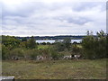
Area Overview for IP3 9UZ
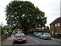
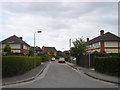
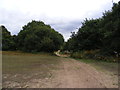
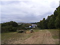
Photos of IP3 9UZ


Area Information
Living in IP3 9UZ means being part of a tightly knit residential cluster in eastern England, where 1,685 residents occupy 2.5 hectares of land. The area’s compact size fosters a close-knit community, with a population density of 793 people per square kilometre. This postcode is defined by its small-scale living, where homes are predominantly houses rather than flats, reflecting a quieter, more private lifestyle. The area’s proximity to rail networks and a ferry landing at Shotley Point Marina offers practical connectivity, while local shops and services cater to daily needs. With a median age of 47, the community leans towards adults aged 30–64, suggesting a stable, established demographic. For those seeking a balance between residential tranquillity and accessible amenities, IP3 9UZ provides a focused, manageable environment. Its limited size means residents are likely to know their neighbours, and the area’s infrastructure supports both everyday convenience and broader regional travel.
- Area Type
- Postcode
- Area Size
- 2.5 hectares
- Population
- 1685
- Population Density
- 793 people/km²
The property market in IP3 9UZ is shaped by its small size and focus on owner-occupation. With 53% of homes owned by residents, the area leans towards a stable, long-term market rather than a transient rental scene. The predominant accommodation type is houses, which suggests a preference for private, family-oriented living. Given the area’s limited size, the housing stock is constrained, meaning buyers may find fewer options compared to larger regions. However, the proximity to rail networks, including Derby Road Railway Station, and the Shotley Point Marina Ferry Landing enhances the appeal for those prioritising connectivity. For buyers, this small postcode offers a compact, manageable environment where properties are likely to be well-maintained and integrated into the local community. The challenge lies in the limited availability of homes, which could make the market competitive for those seeking to move in.
House Prices in IP3 9UZ
Showing 11 properties
| Address | Type | Beds | Baths | Last Sale Price | Last Sale Date | |
|---|---|---|---|---|---|---|
| 6 Fen Bight Walk, Ipswich, IP3 9UZ | Semi-detached | 4 | 3 | £350,000 | Jul 2024 | |
| 3 Fen Bight Walk, Ipswich, IP3 9UZ | Detached | 4 | 3 | £470,000 | Aug 2023 | |
| 1 Fen Bight Walk, Ipswich, IP3 9UZ | house | 4 | 3 | £455,000 | Nov 2021 | |
| 10 Fen Bight Walk, Ipswich, IP3 9UZ | house | - | - | £449,950 | Nov 2016 | |
| 4 Fen Bight Walk, Ipswich, IP3 9UZ | house | - | - | £234,950 | Mar 2016 | |
| 2 Fen Bight Walk, Ipswich, IP3 9UZ | house | - | - | £235,450 | Mar 2016 | |
| 8 Fen Bight Walk, Ipswich, IP3 9UZ | house | - | - | £234,950 | Dec 2015 | |
| 5 Fen Bight Walk, Ipswich, IP3 9UZ | house | - | - | £430,000 | May 2014 | |
| 2 Fen Bight Walk, Ipswich, IP3 9UZ | Detached | - | - | - | - | |
| 6 Fen Bight Walk, Ipswich, IP3 9UZ | Detached | - | - | - | - |
Energy Efficiency in IP3 9UZ
Life in IP3 9UZ is supported by a range of nearby amenities that cater to daily needs and leisure. The area has five retail outlets, including Lidl Crane and the East of England Co-operative Co, ensuring residents have access to groceries and essentials without long journeys. Rail stations such as Derby Road Railway Station provide reliable commuting options, while the Shotley Point Marina Ferry Landing offers a connection to water-based activities and travel. The compact nature of the area means these amenities are within practical reach, contributing to a convenient lifestyle. The presence of multiple rail entrances and a ferry suggests a community that values both traditional and alternative transport methods. For residents, this combination of retail, transport, and connectivity fosters a self-contained yet connected way of life, where local needs are met without the need for extensive travel.
Amenities
Schools
| Rank | School | Type | Entry gender | Ages |
|---|
Explore more schools in this area
Go to Schools tabDemographics
The community in IP3 9UZ is predominantly composed of adults aged 30–64, with a median age of 47. This suggests a mature, settled population, likely with established careers and families. Home ownership rates stand at 53%, indicating a mix of owner-occupied properties and rental homes. The area is characterised by houses rather than flats, reflecting a preference for single-family living. Ethnically, the population is predominantly White, with no specific data on other groups provided. The high population density of 793 people per square kilometre means living spaces are closely packed, which can influence local dynamics. While this density may support a vibrant retail scene—five shops, including Lidl Crane and the East of England Co-operative Co—residents may experience a more compact, communal lifestyle. The absence of specific deprivation data means quality of life is inferred from infrastructure and amenities, which appear adequate for daily living.
Household Size
Accommodation Type
Tenure
Ethnic Group
Religion
Household Composition
Age
Household Deprivation
NS-SEC
Explore more demographic insights in this area
Go to Demographics tabPlanning
Planning Constraints
- Flood RiskPremium
- Ramsar Wetland SitesPremium
- Area of Outstanding Natural BeautyPremium
- Protected Nature ReservePremium
- Protected WoodlandPremium