Area Overview for IP3 9UU
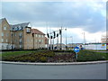
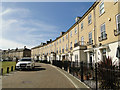
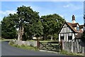
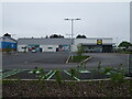
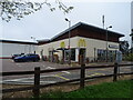
Photos of IP3 9UU


Area Information
Living in IP3 9UU means inhabiting a small, tightly packed residential cluster in England, where 1,685 people reside across 311 square metres. The area’s compact size and high population density of 793 people per square kilometre suggest a closely knit community, though its limited footprint means amenities and services are concentrated. This postcode area is not defined by sprawling suburbs or commercial hubs but by its proximity to practical transport links. The demographic profile hints at a mature population, with a median age of 47, and a focus on owner-occupied homes. Daily life here is likely shaped by the availability of nearby rail stations, retail outlets, and the Shotley Point Marina Ferry Landing, which connects to broader regional networks. While the area lacks natural beauty designations or protected landscapes, its accessibility to rail and ferry services may appeal to commuters or those seeking a balance between residential tranquillity and connectivity. The challenge lies in the high crime risk, which requires residents to consider security measures. For those prioritising convenience over vast open spaces, IP3 9UU offers a compact, functional living environment.
- Area Type
- Postcode
- Area Size
- 311 m²
- Population
- 1685
- Population Density
- 793 people/km²
The property market in IP3 9UU is characterised by a 53% home ownership rate, indicating that just over half of properties are owner-occupied. The accommodation type is exclusively houses, which is unusual for a small postcode area and suggests a focus on single-family homes rather than flats or apartments. This configuration may appeal to buyers seeking traditional housing stock, though the limited size of the area means the market is not expansive. The high proportion of owner-occupied properties implies a relatively stable market, with fewer rental properties available. For buyers, this means competition for homes may be fierce, particularly given the area’s compact nature. The absence of protected land or planning constraints could make development or renovation easier, but the high crime risk may deter some investors. Those considering IP3 9UU should weigh the benefits of a tightly clustered, house-dominated market against the need for enhanced security measures.
House Prices in IP3 9UU
Showing 1 properties
| Address | Type | Beds | Baths | Last Sale Price | Last Sale Date | |
|---|---|---|---|---|---|---|
| 1 Boysenberry Walk, Ipswich, IP3 9UU | house | 5 | 3 | £245,000 | Nov 2021 |
Energy Efficiency in IP3 9UU
Residents of IP3 9UU have access to five retail outlets, including Lidl Crane and East of England Co-operative Co, providing everyday shopping options within practical reach. The area’s rail network, with five stations such as Derby Road Railway Station, facilitates easy travel to nearby towns and cities. The Shotley Point Marina Ferry Landing adds another layer of mobility, linking the area to waterfront destinations. While there are no named parks or leisure facilities in the data, the compact layout ensures amenities are closely clustered. The presence of multiple retail and transport points suggests a lifestyle focused on convenience and accessibility. For those who enjoy proximity to services without the need for long commutes, IP3 9UU offers a mix of practicality and limited local character. However, the absence of named recreational spaces or dining venues means residents may need to travel further for leisure activities.
Amenities
Schools
| Rank | School | Type | Entry gender | Ages |
|---|
Explore more schools in this area
Go to Schools tabDemographics
The community in IP3 9UU is predominantly composed of adults aged 30–64, with a median age of 47. This suggests a stable population of working-age individuals and families, though the absence of younger or older demographics may indicate limited generational turnover. Home ownership stands at 53%, meaning nearly half of residents live in their own homes, while the remaining 47% are likely renters. The accommodation type is primarily houses, which aligns with the area’s small size and suggests a focus on single-family dwellings rather than apartments. The predominant ethnic group is White, with no specific data provided on other groups. The high population density of 793 people per square kilometre, combined with the compact area, implies a mix of closely spaced properties. While no deprivation data is explicitly stated, the lack of protected natural areas or cultural diversity may influence the area’s character. Residents here may value proximity to transport and retail over expansive green spaces.
Household Size
Accommodation Type
Tenure
Ethnic Group
Religion
Household Composition
Age
Household Deprivation
NS-SEC
Explore more demographic insights in this area
Go to Demographics tabPlanning
Planning Constraints
- Flood RiskPremium
- Ramsar Wetland SitesPremium
- Area of Outstanding Natural BeautyPremium
- Protected Nature ReservePremium
- Protected WoodlandPremium