Area Overview for IP3 8NF
Photos of IP3 8NF
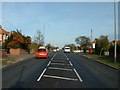
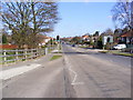
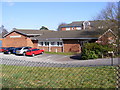
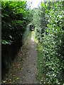
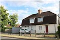
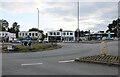
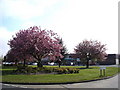
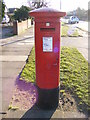
36 photos from this area
Area Information
Key information about the IP3 8NF including its size, population, and administrative classification.
- Area Type
- Postcode
- Area Size
- 1.2 hectares
- Population
- 1476
- Population Density
- 1666 people/km²
House Prices in IP3 8NF
11
Properties
£343,800
Average Sold Price
£93,000
Lowest Price
£730,000
Highest Price
Showing 11 properties
| Address | Type | Beds | Baths | Last Sale Price | Last Sale Date | |
|---|---|---|---|---|---|---|
| 663 Foxhall Road, Rushmere St Andrew, IP3 8NF | house | - | - | £730,000 | Feb 2021 | |
| 667 Foxhall Road, Rushmere St Andrew, IP3 8NF | Detached | 3 | 1 | £345,000 | Jul 2020 | |
| 673 Foxhall Road, Rushmere St Andrew, IP3 8NF | Bungalow | - | - | £321,000 | Jul 2015 | |
| 671 Foxhall Road, Rushmere St Andrew, IP3 8NF | Bungalow | 4 | - | £230,000 | Aug 2013 | |
| 669 Foxhall Road, Rushmere St Andrew, IP3 8NF | Detached | - | - | £93,000 | Apr 2011 | |
| 657 Foxhall Road, Rushmere St Andrew, IP3 8NF | Chalet | 5 | 2 | - | - | |
| 655 Foxhall Road, Rushmere St Andrew, IP3 8NF | Detached | 4 | 2 | - | - | |
| 661 Foxhall Road, Rushmere St Andrew, IP3 8NF | Detached | - | - | - | - | |
| 675 Foxhall Road, Rushmere St Andrew, IP3 8NF | Detached | - | - | - | - | |
| 665 Foxhall Road, Rushmere St Andrew, IP3 8NF | Detached | - | - | - | - |
Page 1 of 2
Energy Efficiency in IP3 8NF
Amenities
Schools
| Rank | School | Type | Entry gender | Ages |
|---|
Explore more schools in this area
Go to Schools tabDemographics
Household Size
Two person
most common
Accommodation Type
Houses
most common
Tenure
93
majority
Ethnic Group
White
most common
Religion
N/A
most common
Household Composition
N/A
most common
Age
47
median
Adults (30-64 years)
most common
Household Deprivation
N/A
with no deprivation
NS-SEC
39
in Lower managerial occupations
Explore more demographic insights in this area
Go to Demographics tabPlanning
Planning Constraints
- Flood RiskPremium
- Ramsar Wetland SitesPremium
- Area of Outstanding Natural BeautyPremium
- Protected Nature ReservePremium
- Protected WoodlandPremium