Area Overview for IP3 8DP
Photos of IP3 8DP
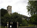
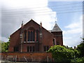
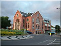
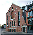
100 photos from this area
Area Information
Key information about the IP3 8DP including its size, population, and administrative classification.
- Area Type
- Postcode
- Area Size
- 4693 m²
- Population
- 1544
- Population Density
- 6952 people/km²
House Prices in IP3 8DP
12
Properties
£249,778
Average Sold Price
£122,500
Lowest Price
£323,000
Highest Price
Showing 12 properties
| Address | Type | Beds | Baths | Last Sale Price | Last Sale Date | |
|---|---|---|---|---|---|---|
| 157 Alan Road, Ipswich, IP3 8DP | Semi-detached | 4 | - | £323,000 | Sep 2019 | |
| 141 Alan Road, Ipswich, IP3 8DP | house | 4 | 4 | £275,000 | Dec 2017 | |
| 155 Alan Road, Ipswich, IP3 8DP | Semi-detached | 1 | 3 | £285,000 | Apr 2016 | |
| 147 Alan Road, Ipswich, IP3 8DP | Semi-detached | 4 | - | £250,000 | Sep 2013 | |
| 163 Alan Road, Ipswich, IP3 8DP | Bungalow | - | - | £122,500 | Feb 2013 | |
| 137 Alan Road, Ipswich, IP3 8DP | house | 4 | - | £277,500 | Jul 2012 | |
| 143 Alan Road, Ipswich, IP3 8DP | Terraced | - | - | £265,000 | Jul 2003 | |
| 139 Alan Road, Ipswich, IP3 8DP | Semi-detached | 4 | 3 | £225,000 | Apr 2001 | |
| 149 Alan Road, Ipswich, IP3 8DP | Semi-detached | - | - | £225,000 | Dec 2000 | |
| 159 Alan Road, Ipswich, IP3 8DP | Semi-detached | 5 | 2 | - | - |
Page 1 of 2
Energy Efficiency in IP3 8DP
Amenities
Schools
| Rank | School | Type | Entry gender | Ages |
|---|
Explore more schools in this area
Go to Schools tabDemographics
Household Size
One person
most common
Accommodation Type
Houses
most common
Tenure
63
majority
Ethnic Group
White
most common
Religion
N/A
most common
Household Composition
N/A
most common
Age
47
median
Adults (30-64 years)
most common
Household Deprivation
N/A
with no deprivation
NS-SEC
31
in Lower managerial occupations
Explore more demographic insights in this area
Go to Demographics tabPlanning
Planning Constraints
- Flood RiskPremium
- Ramsar Wetland SitesPremium
- Area of Outstanding Natural BeautyPremium
- Protected Nature ReservePremium
- Protected WoodlandPremium