Area Overview for IP3 8BS
Photos of IP3 8BS

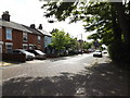
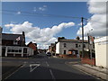
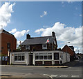
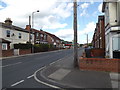
97 photos from this area
Area Information
Key information about the IP3 8BS including its size, population, and administrative classification.
- Area Type
- Postcode
- Area Size
- 4148 m²
- Population
- 1544
- Population Density
- 6952 people/km²
House Prices in IP3 8BS
16
Properties
£186,545
Average Sold Price
£84,000
Lowest Price
£252,500
Highest Price
Showing 16 properties
| Address | Type | Beds | Baths | Last Sale Price | Last Sale Date | |
|---|---|---|---|---|---|---|
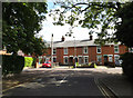
| 38 Upper Cavendish Street, Ipswich, IP3 8BS | Semi-detached | 3 | 1 | £169,000 | Oct 2025 | |
| 17 Upper Cavendish Street, Ipswich, IP3 8BS | Semi-detached | 3 | 1 | £187,500 | Mar 2025 | |
| 32 Upper Cavendish Street, Ipswich, IP3 8BS | Semi-detached | 3 | 1 | £156,000 | Feb 2025 | |
| 26 Upper Cavendish Street, Ipswich, IP3 8BS | Semi-detached | 2 | 1 | £205,000 | Aug 2023 | |
| 24 Upper Cavendish Street, Ipswich, IP3 8BS | Semi-detached | 3 | 1 | £238,000 | Nov 2022 | |
| 15 Upper Cavendish Street, Ipswich, IP3 8BS | Semi-detached | 3 | 1 | £252,500 | Apr 2022 | |
| 30 Upper Cavendish Street, Ipswich, IP3 8BS | Semi-detached | 3 | 1 | £215,000 | Jan 2022 | |
| 21 Upper Cavendish Street, Ipswich, IP3 8BS | Semi-detached | 3 | - | £175,000 | Sep 2017 | |
| 13 Upper Cavendish Street, Ipswich, IP3 8BS | Semi-detached | 3 | 1 | £222,000 | Nov 2016 | |
| 19 Upper Cavendish Street, Ipswich, IP3 8BS | Semi-detached | 2 | - | £148,000 | Aug 2014 |
Page 1 of 2
Energy Efficiency in IP3 8BS
Amenities
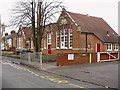
Schools
| Rank | School | Type | Entry gender | Ages |
|---|
Explore more schools in this area
Go to Schools tabDemographics
Household Size
One person
most common
Accommodation Type
Houses
most common
Tenure
63
majority
Ethnic Group
White
most common
Religion
N/A
most common
Household Composition
N/A
most common
Age
47
median
Adults (30-64 years)
most common
Household Deprivation
N/A
with no deprivation
NS-SEC
31
in Lower managerial occupations
Explore more demographic insights in this area
Go to Demographics tabPlanning
Planning Constraints
- Flood RiskPremium
- Ramsar Wetland SitesPremium
- Area of Outstanding Natural BeautyPremium
- Protected Nature ReservePremium
- Protected WoodlandPremium