Area Overview for IP28 7NU
Photos of IP28 7NU
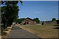

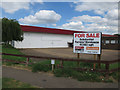
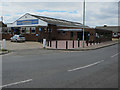
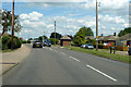
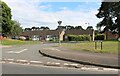
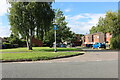

21 photos from this area
Area Information
Key information about the IP28 7NU including its size, population, and administrative classification.
- Area Type
- Postcode
- Area Size
- 1.5 hectares
- Population
- 1522
- Population Density
- 5858 people/km²
House Prices in IP28 7NU
39
Properties
£96,497
Average Sold Price
£24,960
Lowest Price
£166,000
Highest Price
Showing 39 properties
| Address | Type | Beds | Baths | Last Sale Price | Last Sale Date | |
|---|---|---|---|---|---|---|
| 57 St Johns Close, Mildenhall, IP28 7NU | Terraced | 3 | 1 | £166,000 | May 2022 | |
| 66 St Johns Close, Mildenhall, IP28 7NU | Terraced | 3 | 1 | £135,000 | Jan 2022 | |
| 59 St Johns Close, Mildenhall, IP28 7NU | Terraced | 3 | 1 | £140,000 | Sep 2018 | |
| 67 St Johns Close, Mildenhall, IP28 7NU | Terraced | 3 | 1 | £128,000 | Mar 2016 | |
| 33 St Johns Close, Mildenhall, IP28 7NU | Detached | 3 | - | £138,000 | Apr 2015 | |
| 55 St Johns Close, Mildenhall, IP28 7NU | Bungalow | 1 | - | £84,000 | Oct 2013 | |
| 35 St Johns Close, Mildenhall, IP28 7NU | house | - | - | £110,000 | Jun 2007 | |
| 32 St Johns Close, Mildenhall, IP28 7NU | Terraced | 3 | 1 | £116,000 | Jun 2004 | |
| 60 St Johns Close, Mildenhall, IP28 7NU | Detached | 3 | 1 | £85,000 | Aug 2002 | |
| 46 St Johns Close, Mildenhall, IP28 7NU | house | - | - | £60,000 | May 2002 |
Page 1 of 4
Energy Efficiency in IP28 7NU
Amenities
Schools
| Rank | School | Type | Entry gender | Ages |
|---|
Explore more schools in this area
Go to Schools tabDemographics
Household Size
Family (3-5 people)
most common
Accommodation Type
Houses
most common
Tenure
41
majority
Ethnic Group
White
most common
Religion
N/A
most common
Household Composition
N/A
most common
Age
47
median
Adults (30-64 years)
most common
Household Deprivation
N/A
with no deprivation
NS-SEC
18
in Lower managerial occupations
Explore more demographic insights in this area
Go to Demographics tabPlanning
Planning Constraints
- Flood RiskPremium
- Ramsar Wetland SitesPremium
- Area of Outstanding Natural BeautyPremium
- Protected Nature ReservePremium
- Protected WoodlandPremium