Area Overview for IP27 9ES
Photos of IP27 9ES
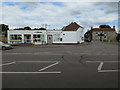
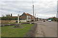
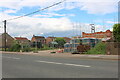
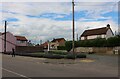
64 photos from this area
Area Information
Key information about the IP27 9ES including its size, population, and administrative classification.
- Area Type
- Postcode
- Area Size
- 1.5 hectares
- Population
- 1576
- Population Density
- 705 people/km²
House Prices in IP27 9ES
20
Properties
£221,091
Average Sold Price
£137,500
Lowest Price
£290,000
Highest Price
Showing 20 properties
| Address | Type | Beds | Baths | Last Sale Price | Last Sale Date | |
|---|---|---|---|---|---|---|
| 21 Broom Road, Lakenheath, IP27 9ES | Bungalow | 3 | 1 | £275,000 | Jun 2025 | |
| 3 Broom Road, Lakenheath, IP27 9ES | Detached | 3 | 2 | £290,000 | Feb 2023 | |
| 19 Broom Road, Lakenheath, IP27 9ES | Bungalow | - | - | £212,000 | Dec 2021 | |
| 12 Broom Road, Lakenheath, IP27 9ES | Bungalow | - | - | £240,000 | Mar 2021 | |
| 10 Broom Road, Lakenheath, IP27 9ES | Detached | 3 | 2 | £205,000 | Sep 2017 | |
| 22 Broom Road, Lakenheath, IP27 9ES | Bungalow | 2 | - | £185,000 | Jun 2014 | |
| 9A Broom Road, Lakenheath, IP27 9ES | Bungalow | 4 | 3 | £248,000 | Mar 2014 | |
| 4 Broom Road, Lakenheath, IP27 9ES | Bungalow | 4 | 3 | £137,500 | Nov 2011 | |
| Blossom Hill, 9 Broom Road, Lakenheath, IP27 9ES | Bungalow | - | - | £246,000 | Sep 2011 | |
| 1 Broom Road, Lakenheath, IP27 9ES | Detached | 3 | 1 | £165,000 | Mar 2006 |
Page 1 of 2
Energy Efficiency in IP27 9ES
Amenities
Schools
| Rank | School | Type | Entry gender | Ages |
|---|
Explore more schools in this area
Go to Schools tabDemographics
Household Size
Two person
most common
Accommodation Type
Houses
most common
Tenure
70
majority
Ethnic Group
White
most common
Religion
N/A
most common
Household Composition
N/A
most common
Age
47
median
Adults (30-64 years)
most common
Household Deprivation
N/A
with no deprivation
NS-SEC
28
in Lower managerial occupations
Explore more demographic insights in this area
Go to Demographics tabPlanning
Planning Constraints
- Flood RiskPremium
- Ramsar Wetland SitesPremium
- Area of Outstanding Natural BeautyPremium
- Protected Nature ReservePremium
- Protected WoodlandPremium