Area Overview for IP26 4LS
Photos of IP26 4LS
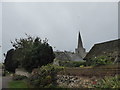
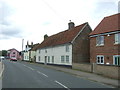
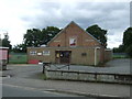
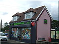
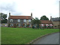
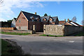
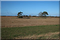
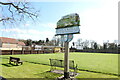
29 photos from this area
Area Information
Key information about the IP26 4LS including its size, population, and administrative classification.
- Area Type
- Postcode
- Area Size
- 1.6 hectares
- Population
- 1659
- Population Density
- 52 people/km²
House Prices in IP26 4LS
14
Properties
£239,714
Average Sold Price
£100,000
Lowest Price
£475,000
Highest Price
Showing 14 properties
| Address | Type | Beds | Baths | Last Sale Price | Last Sale Date | |
|---|---|---|---|---|---|---|
| The Hamlet, Reeves Lane, Hockwold Cum Wilton, IP26 4LS | Bungalow | 4 | 2 | £475,000 | Oct 2023 | |
| Myklinville, Reeves Lane, Hockwold Cum Wilton, IP26 4LS | Detached | 4 | 2 | £250,000 | Oct 2018 | |
| The Barns, Reeves Lane, Hockwold Cum Wilton, IP26 4LS | Bungalow | 3 | - | £220,000 | Dec 2013 | |
| Flint House, Reeves Lane, Hockwold Cum Wilton, IP26 4LS | Detached | 3 | - | £220,000 | Aug 2013 | |
| 2 Reeves Lane, Hockwold Cum Wilton, IP26 4LS | Bungalow | 4 | 2 | £100,000 | May 2008 | |
| The Birches, Reeves Lane, Hockwold Cum Wilton, IP26 4LS | Bungalow | 3 | - | £238,000 | May 2007 | |
| Springfield, 3 Reeves Lane, Hockwold Cum Wilton, IP26 4LS | Detached | - | - | £175,000 | Dec 2006 | |
| Oakwood, Reeves Lane, Hockwold Cum Wilton, IP26 4LS | house | - | - | - | - | |
| Craythornes, Reeves Lane, Hockwold Cum Wilton, IP26 4LS | Detached | - | - | - | - | |
| Annexe, Flint House, Reeves Lane, Hockwold Cum Wilton, IP26 4LS | Bungalow | - | - | - | - |
Page 1 of 2
Energy Efficiency in IP26 4LS
Amenities
Schools
| Rank | School | Type | Entry gender | Ages |
|---|
Explore more schools in this area
Go to Schools tabDemographics
Household Size
Two person
most common
Accommodation Type
Houses
most common
Tenure
67
majority
Ethnic Group
White
most common
Religion
N/A
most common
Household Composition
N/A
most common
Age
47
median
Adults (30-64 years)
most common
Household Deprivation
N/A
with no deprivation
NS-SEC
28
in Lower managerial occupations
Explore more demographic insights in this area
Go to Demographics tabPlanning
Planning Constraints
- Flood RiskPremium
- Ramsar Wetland SitesPremium
- Area of Outstanding Natural BeautyPremium
- Protected Nature ReservePremium
- Protected WoodlandPremium