Area Overview for IP26 4LR
Photos of IP26 4LR
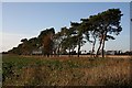
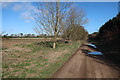


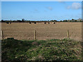

6 photos from this area
Area Information
Key information about the IP26 4LR including its size, population, and administrative classification.
- Area Type
- Postcode
- Area Size
- 2.8 km²
- Population
- 1659
- Population Density
- 52 people/km²
House Prices in IP26 4LR
34
Properties
£263,227
Average Sold Price
£128,500
Lowest Price
£480,000
Highest Price
Showing 34 properties
| Address | Type | Beds | Baths | Last Sale Price | Last Sale Date | |
|---|---|---|---|---|---|---|
| 24 Mill Lane, Hockwold Cum Wilton, IP26 4LR | Bungalow | - | - | £275,000 | Sep 2025 | |
| Icini, 40 Mill Lane, Hockwold Cum Wilton, IP26 4LR | Bungalow | - | - | £210,000 | Mar 2021 | |
| The Antlers, 95 Mill Lane, Hockwold Cum Wilton, IP26 4LR | Bungalow | - | - | £230,000 | Oct 2018 | |
| 23 Mill Lane, Hockwold Cum Wilton, IP26 4LR | house | 4 | - | £480,000 | Feb 2017 | |
| Dun It All, 16 Mill Lane, Hockwold Cum Wilton, IP26 4LR | Bungalow | 2 | - | £190,000 | Feb 2017 | |
| 21 Mill Lane, Hockwold Cum Wilton, IP26 4LR | Detached | 3 | - | £360,000 | Sep 2015 | |
| 15 Mill Lane, Hockwold Cum Wilton, IP26 4LR | Detached | 5 | 3 | £270,000 | Jul 2015 | |
| Anfield, 32 Mill Lane, Hockwold Cum Wilton, IP26 4LR | Bungalow | 4 | - | £197,000 | Jan 2012 | |
| Mill House, 27 Mill Lane, Hockwold Cum Wilton, IP26 4LR | Detached | - | - | £275,000 | Jan 2012 | |
| The Lanes, 11 Mill Lane, Hockwold Cum Wilton, IP26 4LR | Retail | 2 | 2 | £128,500 | May 2011 |
Page 1 of 4
Energy Efficiency in IP26 4LR
Amenities
Schools
| Rank | School | Type | Entry gender | Ages |
|---|
Explore more schools in this area
Go to Schools tabDemographics
Household Size
Two person
most common
Accommodation Type
Houses
most common
Tenure
67
majority
Ethnic Group
White
most common
Religion
N/A
most common
Household Composition
N/A
most common
Age
47
median
Adults (30-64 years)
most common
Household Deprivation
N/A
with no deprivation
NS-SEC
28
in Lower managerial occupations
Explore more demographic insights in this area
Go to Demographics tabPlanning
Planning Constraints
- Flood RiskPremium
- Ramsar Wetland SitesPremium
- Area of Outstanding Natural BeautyPremium
- Protected Nature ReservePremium
- Protected WoodlandPremium