Area Overview for IP22 2DB
Photos of IP22 2DB
Area Information
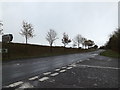
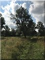
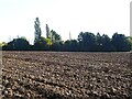
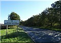
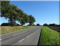
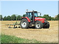
Living in IP22 2DB means being part of a small, tightly knit residential cluster in rural England. With a population of 1,236 spread across 2,027 square metres, the area maintains a low density of 54 people per square kilometre, offering a quiet, uncluttered environment. This postcode is characterised by its modest scale, where daily life unfolds in a setting that balances accessibility with seclusion. The community is predominantly composed of adults aged 30–64, many of whom own their homes. The area’s compact nature means residents can easily access nearby amenities, including retail hubs and a railway station in Diss. While the landscape lacks formal parks or green spaces, the absence of environmental constraints such as protected woodlands or AONB status ensures development flexibility. For those seeking a peaceful, low-crime neighbourhood with a strong sense of local identity, IP22 2DB presents a compelling option.
- Area Type
- Postcode
- Area Size
- 2027 m²
- Population
- 1236
- Population Density
- 54 people/km²
The property market in IP22 2DB is defined by its high home ownership rate (80%) and the prevalence of houses over flats. This suggests a community of long-term residents, many of whom are likely families seeking stable, spacious living arrangements. The small area size and low population density imply limited housing stock, meaning buyers may need to consider nearby zones for more options. The absence of rental properties or commercial developments indicates a focus on private, owner-occupied homes. For prospective buyers, this translates to a market where properties are likely to be well-maintained and hold value, though the limited supply could drive competition. The predominance of houses also appeals to those prioritising space and privacy, aligning with the area’s rural, low-density appeal. However, the small scale of the postcode means buyers must assess both the immediate area and its surrounding regions for comprehensive property searches.
House Prices in IP22 2DB
No properties found in this postcode.
Energy Efficiency in IP22 2DB
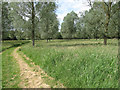
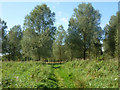
The lifestyle in IP22 2DB is shaped by its proximity to practical amenities, including retail and transport hubs. The Diss area hosts major supermarkets like Aldi, Morrisons, and Tesco, ensuring residents can access groceries and daily essentials without long journeys. The Diss Railway Station provides a direct link to nearby towns, enhancing accessibility for commuters or shoppers. While the area lacks formal parks or leisure facilities, its low population density and absence of environmental constraints suggest open spaces may be available for recreation. The community’s small size fosters a close-knit atmosphere, with local schools and shops acting as social anchors. For those valuing convenience and a quiet lifestyle, the balance of retail, transport, and rural tranquillity makes IP22 2DB a viable choice.
Amenities
Schools
The nearest school to IP22 2DB is Bressingham Primary School, a primary institution with a ‘good’ Ofsted rating. This single school serves the local community, offering education for younger children in a setting that has been recognised for its quality. The absence of secondary schools or other educational institutions in the data means families may need to look further afield for secondary education. However, Bressingham Primary’s rating provides reassurance for parents seeking a reliable foundation for their children’s schooling. The school’s presence also contributes to the area’s community feel, acting as a focal point for local families. For those prioritising strong primary education, this is a significant advantage, though secondary schooling options would require additional planning.
| Rank | School | Type | Entry gender | Ages |
|---|
Explore more schools in this area
Go to Schools tabDemographics
The demographic profile of IP22 2DB reflects a mature, stable population. The median age of 47 indicates a community dominated by middle-aged adults, with 80% of residents owning their homes. This high home ownership rate suggests long-term residency and a preference for settled living. The accommodation is largely composed of houses, not flats, aligning with the area’s rural character. The predominant ethnic group is White, with no specific data on other demographics provided. The population density of 54 people per square kilometre ensures a spacious, low-pressure living environment. This combination of age profile, ownership levels, and housing type points to a community prioritising stability over transient lifestyles. The absence of detailed deprivation data means the quality of life remains inferred from the area’s safety and infrastructure, which appear to support a comfortable, if unassuming, existence.
Household Size
Accommodation Type
Tenure
Ethnic Group
Religion
Household Composition
Age
Household Deprivation
NS-SEC
Explore more demographic insights in this area
Go to Demographics tabPlanning
Planning Constraints
- Flood RiskPremium
- Ramsar Wetland SitesPremium
- Area of Outstanding Natural BeautyPremium
- Protected Nature ReservePremium
- Protected WoodlandPremium