Area Overview for IP21 5RD
Photos of IP21 5RD
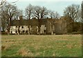
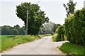
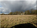
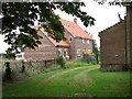
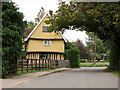
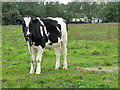
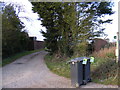
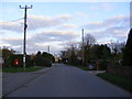
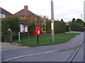
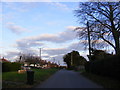
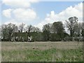
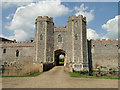
26 photos from this area
Area Information
Key information about the IP21 5RD including its size, population, and administrative classification.
- Area Type
- Postcode
- Area Size
- 10.9 hectares
- Population
- 2036
- Population Density
- 40 people/km²
House Prices in IP21 5RD
23
Properties
£194,020
Average Sold Price
£24,600
Lowest Price
£375,000
Highest Price
Showing 23 properties
| Address | Type | Beds | Baths | Last Sale Price | Last Sale Date | |
|---|---|---|---|---|---|---|
| 12, Castle Crescent, Vicarage Road, Wingfield, IP21 5RD | Semi-detached | 3 | 2 | £375,000 | Jan 2025 | |
| 17, Castle Crescent, Vicarage Road, Wingfield, IP21 5RD | Terraced | 3 | 2 | £245,000 | Mar 2021 | |
| 13, Castle Crescent, Vicarage Road, Wingfield, IP21 5RD | house | 3 | - | £190,500 | Jul 2014 | |
| 3, Castle Crescent, Vicarage Road, Wingfield, IP21 5RD | Semi-detached | - | - | £135,000 | Sep 2004 | |
| 21, Castle Crescent, Vicarage Road, Wingfield, IP21 5RD | Semi-detached | - | - | £24,600 | Dec 1996 | |
| 23, Hawthorn House, Castle Crescent, Vicarage Road, Wingfield, IP21 5RD | Semi-detached | 3 | 1 | - | - | |
| 8, Castle Crescent, Vicarage Road, Wingfield, IP21 5RD | house | 2 | - | - | - | |
| 7, Castle Crescent, Vicarage Road, Wingfield, IP21 5RD | house | - | - | - | - | |
| 5, Castle Crescent, Vicarage Road, Wingfield, IP21 5RD | Semi-detached | - | - | - | - | |
| 2, Castle Crescent, Vicarage Road, Wingfield, IP21 5RD | Semi-detached | - | - | - | - |
Page 1 of 3
Energy Efficiency in IP21 5RD
Amenities
Schools
| Rank | School | Type | Entry gender | Ages |
|---|
Explore more schools in this area
Go to Schools tabDemographics
Household Size
Two person
most common
Accommodation Type
Houses
most common
Tenure
79
majority
Ethnic Group
White
most common
Religion
N/A
most common
Household Composition
N/A
most common
Age
47
median
Adults (30-64 years)
most common
Household Deprivation
N/A
with no deprivation
NS-SEC
37
in Lower managerial occupations
Explore more demographic insights in this area
Go to Demographics tabPlanning
Planning Constraints
- Flood RiskPremium
- Ramsar Wetland SitesPremium
- Area of Outstanding Natural BeautyPremium
- Protected Nature ReservePremium
- Protected WoodlandPremium