Area Overview for IP21 5AT
Photos of IP21 5AT
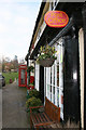
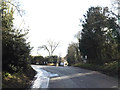
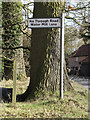
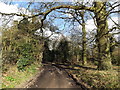
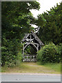
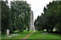
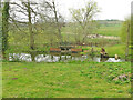
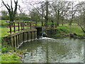
75 photos from this area
Area Information
Key information about the IP21 5AT including its size, population, and administrative classification.
- Area Type
- Postcode
- Area Size
- 2.1 hectares
- Population
- 2036
- Population Density
- 40 people/km²
House Prices in IP21 5AT
13
Properties
£415,193
Average Sold Price
£88,500
Lowest Price
£1,260,000
Highest Price
Showing 13 properties
| Address | Type | Beds | Baths | Last Sale Price | Last Sale Date | |
|---|---|---|---|---|---|---|
| 40, Church Hill, Low Street, Hoxne, IP21 5AT | Cottage | 4 | 2 | £220,000 | Nov 2023 | |
| The Vicarage, Church Hill, Hoxne, IP21 5AT | Detached | 6 | 4 | £1,260,000 | Oct 2023 | |
| Yew Tree House, 37-39 Church Hill, Hoxne, IP21 5AT | Semi-detached | - | - | £635,000 | Mar 2021 | |
| Fir House, Church Hill, Hoxne, IP21 5AT | Detached | - | - | £925,000 | Dec 2020 | |
| The Surgery, Church Hill, Hoxne, IP21 5AT | Semi-detached | 1 | 1 | £163,233 | Jul 2020 | |
| Rambler Cottage, Low Street, Hoxne, IP21 5AT | Cottage | 3 | 1 | £163,000 | May 2014 | |
| Church Hill Cottage, Green Street, Hoxne, IP21 5AT | house | - | - | £192,000 | May 2011 | |
| High House, Church Hill, Hoxne, IP21 5AT | Semi-detached | 4 | 1 | £90,000 | Dec 1997 | |
| Clover Cottage, Church Hill, Hoxne, IP21 5AT | Semi-detached | - | - | £88,500 | Nov 1997 | |
| Hill House, Church Hill, Hoxne, IP21 5AT | house | 3 | - | - | - |
Page 1 of 2
Energy Efficiency in IP21 5AT
Amenities
Schools
| Rank | School | Type | Entry gender | Ages |
|---|
Explore more schools in this area
Go to Schools tabDemographics
Household Size
Two person
most common
Accommodation Type
Houses
most common
Tenure
79
majority
Ethnic Group
White
most common
Religion
N/A
most common
Household Composition
N/A
most common
Age
47
median
Adults (30-64 years)
most common
Household Deprivation
N/A
with no deprivation
NS-SEC
37
in Lower managerial occupations
Explore more demographic insights in this area
Go to Demographics tabPlanning
Planning Constraints
- Flood RiskPremium
- Ramsar Wetland SitesPremium
- Area of Outstanding Natural BeautyPremium
- Protected Nature ReservePremium
- Protected WoodlandPremium