Area Overview for IP21 4PD
Photos of IP21 4PD
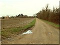
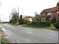
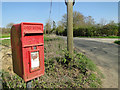
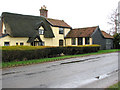
17 photos from this area
Area Information
Key information about the IP21 4PD including its size, population, and administrative classification.
- Area Type
- Postcode
- Area Size
- 1.3 km²
- Population
- 1600
- Population Density
- 112 people/km²
House Prices in IP21 4PD
15
Properties
£414,100
Average Sold Price
£168,000
Lowest Price
£727,500
Highest Price
Showing 15 properties
| Address | Type | Beds | Baths | Last Sale Price | Last Sale Date | |
|---|---|---|---|---|---|---|
| Kachin, Harleston Road, Dickleburgh, IP21 4PD | Bungalow | 4 | 4 | £727,500 | Apr 2023 | |
| Mere House, Harleston Road, Dickleburgh, IP21 4PD | Detached | 4 | 2 | £490,000 | May 2019 | |
| East Cottage, Harleston Road, Dickleburgh, IP21 4PD | house | 4 | 2 | £325,000 | May 2018 | |
| The Gables, Harleston Road, Dickleburgh, IP21 4PD | Bungalow | 5 | - | £360,000 | Sep 2015 | |
| Moorside, Harleston Road, Dickleburgh, IP21 4PD | Bungalow | - | - | £168,000 | Jan 2015 | |
| The Pantiles, Harleston Road, Dickleburgh, IP21 4PD | Bungalow | 3 | 2 | - | - | |
| Kennards, Harleston Road, Dickleburgh, IP21 4PD | Land | - | - | - | - | |
| 2, Lyncroft, Harleston Road, Dickleburgh, IP21 4PD | Semi-detached | 2 | - | - | - | |
| White Horse Farm, Harleston Road, Dickleburgh, IP21 4PD | house | 4 | - | - | - | |
| Langmere Barn, Harleston Road, Dickleburgh, IP21 4PD | Bungalow | 4 | - | - | - |
Page 1 of 2
Energy Efficiency in IP21 4PD
Amenities
Schools
| Rank | School | Type | Entry gender | Ages |
|---|
Explore more schools in this area
Go to Schools tabDemographics
Household Size
Two person
most common
Accommodation Type
Houses
most common
Tenure
71
majority
Ethnic Group
White
most common
Religion
N/A
most common
Household Composition
N/A
most common
Age
47
median
Adults (30-64 years)
most common
Household Deprivation
N/A
with no deprivation
NS-SEC
33
in Lower managerial occupations
Explore more demographic insights in this area
Go to Demographics tabPlanning
Planning Constraints
- Flood RiskPremium
- Ramsar Wetland SitesPremium
- Area of Outstanding Natural BeautyPremium
- Protected Nature ReservePremium
- Protected WoodlandPremium