Area Overview for IP18 6BU
Photos of IP18 6BU
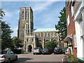
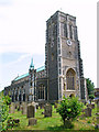
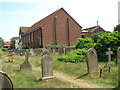
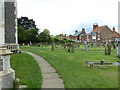
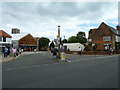
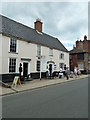
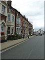
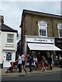
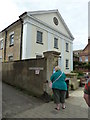
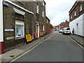

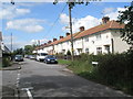
100 photos from this area
Area Information
Key information about the IP18 6BU including its size, population, and administrative classification.
- Area Type
- Postcode
- Area Size
- 2.4 hectares
- Population
- 2178
- Population Density
- 585 people/km²
House Prices in IP18 6BU
45
Properties
£480,181
Average Sold Price
£40,000
Lowest Price
£2,760,000
Highest Price
Showing 45 properties
| Address | Type | Beds | Baths | Last Sale Price | Last Sale Date | |
|---|---|---|---|---|---|---|
| 23 Pier Avenue, Southwold, IP18 6BU | Bungalow | 2 | 1 | £450,000 | May 2024 | |
| Craven Cottage, 51 Pier Avenue, Southwold, IP18 6BU | Detached | 3 | 1 | £2,760,000 | Sep 2023 | |
| 49 Pier Avenue, Southwold, IP18 6BU | Bungalow | - | - | £813,528 | Aug 2023 | |
| 20 Pier Avenue, Southwold, IP18 6BU | Terraced | 2 | 1 | £465,000 | May 2021 | |
| 64 Pier Avenue, Southwold, IP18 6BU | Semi-detached | 3 | 1 | £840,000 | Nov 2020 | |
| 45 Pier Avenue, Southwold, IP18 6BU | Detached | 4 | 2 | £900,000 | Sep 2019 | |
| 37 Pier Avenue, Southwold, IP18 6BU | Detached | 5 | 4 | £504,000 | Dec 2018 | |
| 24 Pier Avenue, Southwold, IP18 6BU | Semi-detached | 4 | 2 | £615,000 | Oct 2018 | |
| 30 Pier Avenue, Southwold, IP18 6BU | Semi-detached | 3 | 1 | £458,000 | Feb 2016 | |
| Oakleigh Villa, 41 Pier Avenue, Southwold, IP18 6BU | Detached | 4 | - | £620,000 | Jul 2014 |
Page 1 of 5
Energy Efficiency in IP18 6BU
Amenities
Schools
| Rank | School | Type | Entry gender | Ages |
|---|
Explore more schools in this area
Go to Schools tabDemographics
Household Size
Two person
most common
Accommodation Type
Houses
most common
Tenure
77
majority
Ethnic Group
White
most common
Religion
N/A
most common
Household Composition
N/A
most common
Age
47
median
Elderly (65+ years)
most common
Household Deprivation
N/A
with no deprivation
NS-SEC
40
in Lower managerial occupations
Explore more demographic insights in this area
Go to Demographics tabPlanning
Planning Constraints
- Flood RiskPremium
- Ramsar Wetland SitesPremium
- Area of Outstanding Natural BeautyPremium
- Protected Nature ReservePremium
- Protected WoodlandPremium