Area Overview for IP16 4QJ
Photos of IP16 4QJ
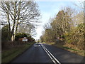
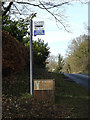
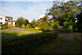
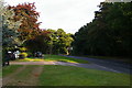
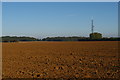
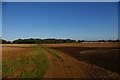
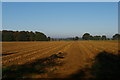
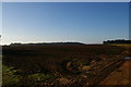
32 photos from this area
Area Information
Key information about the IP16 4QJ including its size, population, and administrative classification.
- Area Type
- Postcode
- Area Size
- 16.9 hectares
- Population
- 2043
- Population Density
- 136 people/km²
House Prices in IP16 4QJ
16
Properties
£358,500
Average Sold Price
£98,000
Lowest Price
£745,000
Highest Price
Showing 16 properties
| Address | Type | Beds | Baths | Last Sale Price | Last Sale Date | |
|---|---|---|---|---|---|---|
| The Lilacs, Aldeburgh Road, Aldringham Cum Thorpe, IP16 4QJ | Bungalow | 2 | 3 | £360,000 | Feb 2025 | |
| Hedgerows, Aldeburgh Road, Aldringham Cum Thorpe, IP16 4QJ | Detached | 4 | 4 | £745,000 | Aug 2023 | |
| Crab Apple Cottage, Aldeburgh Road, Aldringham Cum Thorpe, IP16 4QJ | Detached | 4 | 2 | £475,000 | Apr 2020 | |
| The Glasshouse, Aldeburgh Road, Aldringham Cum Thorpe, IP16 4QJ | house | - | - | £300,000 | Nov 2017 | |
| Dogwood, Aldeburgh Road, Aldringham Cum Thorpe, IP16 4QJ | Detached | 4 | 2 | £370,000 | Feb 2016 | |
| Hawthorns, Aldeburgh Road, Aldringham Cum Thorpe, IP16 4QJ | Bungalow | 2 | - | £270,000 | Aug 2012 | |
| Brackenhow, Aldeburgh Road, Aldringham Cum Thorpe, IP16 4QJ | Detached | - | - | £250,000 | Jan 2005 | |
| Symonds Hyde, Aldeburgh Road, Aldringham Cum Thorpe, IP16 4QJ | Detached | - | - | £98,000 | Jul 1998 | |
| Caravan, The Lilacs, Aldeburgh Road, Aldringham Cum Thorpe, IP16 4QJ | Bungalow | 2 | 1 | - | - | |
| Hazelmere, Aldeburgh Road, Aldringham Cum Thorpe, IP16 4QJ | Bungalow | 3 | 2 | - | - |
Page 1 of 2
Energy Efficiency in IP16 4QJ
Amenities
Schools
| Rank | School | Type | Entry gender | Ages |
|---|
Explore more schools in this area
Go to Schools tabDemographics
Household Size
Two person
most common
Accommodation Type
Houses
most common
Tenure
79
majority
Ethnic Group
White
most common
Religion
N/A
most common
Household Composition
N/A
most common
Age
70
median
Elderly (65+ years)
most common
Household Deprivation
N/A
with no deprivation
NS-SEC
42
in Lower managerial occupations
Explore more demographic insights in this area
Go to Demographics tabPlanning
Planning Constraints
- Flood RiskPremium
- Ramsar Wetland SitesPremium
- Area of Outstanding Natural BeautyPremium
- Protected Nature ReservePremium
- Protected WoodlandPremium