Area Overview for IP12 2TN
Photos of IP12 2TN

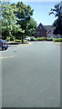
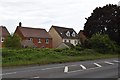
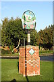
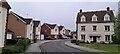
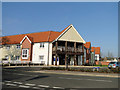


29 photos from this area
Area Information
Key information about the IP12 2TN including its size, population, and administrative classification.
- Area Type
- Postcode
- Area Size
- 11.7 hectares
- Population
- 1906
- Population Density
- 140 people/km²
House Prices in IP12 2TN
35
Properties
£151,378
Average Sold Price
£45,000
Lowest Price
£380,000
Highest Price
Showing 35 properties
| Address | Type | Beds | Baths | Last Sale Price | Last Sale Date | |
|---|---|---|---|---|---|---|
| 3 Suffolk Drive, Rendlesham, IP12 2TN | house | - | - | £380,000 | Nov 2024 | |
| 73 Suffolk Drive, Rendlesham, IP12 2TN | Bungalow | - | - | £250,000 | Aug 2022 | |
| 17 Suffolk Drive, Rendlesham, IP12 2TN | house | - | - | £335,000 | Mar 2022 | |
| 29 Suffolk Drive, Rendlesham, IP12 2TN | Terraced | 5 | 2 | £295,000 | Mar 2022 | |
| 57 Suffolk Drive, Rendlesham, IP12 2TN | Bungalow | - | - | £280,000 | Oct 2021 | |
| 7 Suffolk Drive, Rendlesham, IP12 2TN | house | - | - | £238,000 | May 2019 | |
| 19 Suffolk Drive, Rendlesham, IP12 2TN | Semi-detached | 4 | 3 | £285,000 | Mar 2019 | |
| 59 Suffolk Drive, Rendlesham, IP12 2TN | Bungalow | 3 | 1 | £238,600 | Mar 2018 | |
| 63 Suffolk Drive, Rendlesham, IP12 2TN | Semi-detached | 3 | 1 | £225,000 | May 2017 | |
| 69 Suffolk Drive, Rendlesham, IP12 2TN | Bungalow | 2 | 1 | £217,000 | Jul 2016 |
Page 1 of 4
Energy Efficiency in IP12 2TN
Amenities
Schools
| Rank | School | Type | Entry gender | Ages |
|---|
Explore more schools in this area
Go to Schools tabDemographics
Household Size
Family (3-5 people)
most common
Accommodation Type
Houses
most common
Tenure
67
majority
Ethnic Group
White
most common
Religion
N/A
most common
Household Composition
N/A
most common
Age
47
median
Adults (30-64 years)
most common
Household Deprivation
N/A
with no deprivation
NS-SEC
36
in Lower managerial occupations
Explore more demographic insights in this area
Go to Demographics tabPlanning
Planning Constraints
- Flood RiskPremium
- Ramsar Wetland SitesPremium
- Area of Outstanding Natural BeautyPremium
- Protected Nature ReservePremium
- Protected WoodlandPremium