Area Overview for IP12 2GR
Photos of IP12 2GR
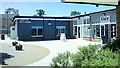
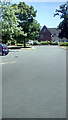
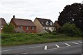
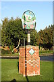
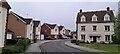
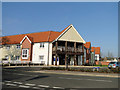


29 photos from this area
Area Information
Key information about the IP12 2GR including its size, population, and administrative classification.
- Area Type
- Postcode
- Area Size
- 4.5 hectares
- Population
- 1906
- Population Density
- 140 people/km²
House Prices in IP12 2GR
34
Properties
£373,089
Average Sold Price
£250,000
Lowest Price
£600,000
Highest Price
Showing 34 properties
| Address | Type | Beds | Baths | Last Sale Price | Last Sale Date | |
|---|---|---|---|---|---|---|
| 22 Knight Road, Rendlesham, IP12 2GR | Detached | 5 | 3 | £600,000 | Oct 2022 | |
| 18 Knight Road, Rendlesham, IP12 2GR | Detached | 5 | 3 | £565,000 | Oct 2022 | |
| 16 Knight Road, Rendlesham, IP12 2GR | Detached | 5 | - | £520,000 | Jul 2022 | |
| 2 Knight Road, Rendlesham, IP12 2GR | Detached | 5 | 3 | £455,000 | Oct 2021 | |
| 26 Knight Road, Rendlesham, IP12 2GR | Detached | 5 | 1 | £530,000 | Jun 2021 | |
| 8 Knight Road, Rendlesham, IP12 2GR | Detached | 5 | 3 | £376,000 | Sep 2020 | |
| 9 Knight Road, Rendlesham, IP12 2GR | Detached | 4 | 3 | £435,000 | Jun 2020 | |
| 23 Knight Road, Rendlesham, IP12 2GR | house | - | - | £423,500 | May 2019 | |
| 17 Knight Road, Rendlesham, IP12 2GR | Detached | 4 | 3 | £412,500 | Oct 2018 | |
| 10 Knight Road, Rendlesham, IP12 2GR | house | - | - | £376,000 | Dec 2017 |
Page 1 of 4
Energy Efficiency in IP12 2GR
Amenities
Schools
| Rank | School | Type | Entry gender | Ages |
|---|
Explore more schools in this area
Go to Schools tabDemographics
Household Size
Family (3-5 people)
most common
Accommodation Type
Houses
most common
Tenure
67
majority
Ethnic Group
White
most common
Religion
N/A
most common
Household Composition
N/A
most common
Age
47
median
Adults (30-64 years)
most common
Household Deprivation
N/A
with no deprivation
NS-SEC
36
in Lower managerial occupations
Explore more demographic insights in this area
Go to Demographics tabPlanning
Planning Constraints
- Flood RiskPremium
- Ramsar Wetland SitesPremium
- Area of Outstanding Natural BeautyPremium
- Protected Nature ReservePremium
- Protected WoodlandPremium