Area Overview for IG10 3BG
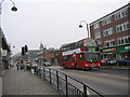
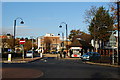
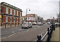
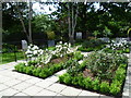
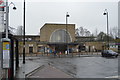
Photos of IG10 3BG


Area Information
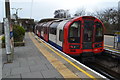
Living in IG10 3BG means inhabiting a tightly packed residential cluster in England, where 1534 people reside across just 1.4 hectares. The area’s high population density of 108,557 people per square kilometre reflects its compact nature, ideal for those seeking a close-knit community. Daily life here is characterised by proximity to essential services and transport links, with five nearby metro stations, including Loughton and Buckhurst Hill, ensuring easy access to London’s transport network. The area’s demographics suggest a mature population, with a median age of 47 and most residents falling within the 30-64 age range. Home ownership is high at 83%, with houses dominating the accommodation type, indicating a stable, family-oriented environment. The low crime risk score of 86 and absence of environmental constraints make this a safe, straightforward place to live, though its small size means amenities are concentrated within a short reach. For buyers, IG10 3BG offers a blend of practicality and security, with a focus on owner-occupied housing and minimal planning restrictions.
- Area Type
- Postcode
- Area Size
- 1.4 hectares
- Population
- 1534
- Population Density
- 3424 people/km²
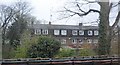
The property market in IG10 3BG is dominated by owner-occupied homes, with 83% of properties owned by residents rather than rented. This suggests a stable market where long-term investment is common, and the housing stock is largely composed of houses rather than flats or apartments. The high home ownership rate indicates a community of settled households, possibly with families seeking space and privacy. Given the area’s small size, the immediate surroundings likely offer similar housing stock, with limited scope for new developments. Buyers should note that the area’s compact nature means property availability is constrained, and competition for homes may be fierce. The absence of planning constraints such as protected woodlands or Areas of Outstanding Natural Beauty allows for straightforward development, though the high population density may limit future expansion. For those prioritising security and stability, IG10 3BG’s property market offers a mix of established homes in a low-risk environment.
House Prices in IG10 3BG
Showing 54 properties
| Address | Type | Beds | Baths | Last Sale Price | Last Sale Date | |
|---|---|---|---|---|---|---|
| 51 Nevill Way, Loughton, IG10 3BG | Terraced | 4 | 2 | £637,000 | Nov 2025 | |
| 69 Nevill Way, Loughton, IG10 3BG | Terraced | 3 | 1 | £515,000 | Oct 2024 | |
| 27 Nevill Way, Loughton, IG10 3BG | Terraced | 3 | 2 | £530,000 | Jun 2024 | |
| 11 Nevill Way, Loughton, IG10 3BG | Terraced | 4 | 2 | £627,500 | Jan 2023 | |
| 23 Nevill Way, Loughton, IG10 3BG | Terraced | 3 | - | £570,000 | Jul 2022 | |
| 16 Nevill Way, Loughton, IG10 3BG | Terraced | 3 | 1 | £465,000 | May 2022 | |
| 6 Nevill Way, Loughton, IG10 3BG | house | - | - | £480,000 | Jun 2021 | |
| 17 Nevill Way, Loughton, IG10 3BG | Terraced | 3 | 1 | £470,000 | Apr 2021 | |
| 12 Nevill Way, Loughton, IG10 3BG | Terraced | 4 | 2 | £530,000 | Mar 2021 | |
| 2 Nevill Way, Loughton, IG10 3BG | Terraced | 3 | 1 | £445,000 | Dec 2018 |
Energy Efficiency in IG10 3BG
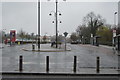
Residents of IG10 3BG have access to a range of nearby amenities within practical reach. Retail options include Sainsburys Loughton, M&S Loughton SF, and Cook Loughton, offering everyday shopping and dining choices. The area’s transport links, including five metro stations and multiple rail stops, provide easy access to broader London networks, facilitating both local and long-distance travel. While specific parks or leisure facilities are not detailed in the data, the absence of environmental constraints like protected woodlands or AONBs suggests open space may be limited. The compact nature of the area means amenities are clustered closely, enhancing convenience for daily life. For those prioritising proximity to services, the combination of retail outlets and transport hubs ensures a functional lifestyle. However, the lack of named parks or recreational areas implies that outdoor activities may require travel beyond the immediate vicinity.
Amenities
Schools
| Rank | School | Type | Entry gender | Ages |
|---|
Explore more schools in this area
Go to Schools tabDemographics
The community in IG10 3BG is predominantly composed of adults aged 30-64, reflecting a median age of 47. This suggests a population skewed towards middle-aged individuals, likely with established careers and families. With 83% of homes owned by residents, the area is largely owner-occupied, which often correlates with long-term residency and community stability. The accommodation type is primarily houses, which, combined with the high home ownership rate, indicates a preference for private, standalone properties. The predominant ethnic group is White, though specific data on diversity or minority representation is not provided. The population density of 108,557 people per square kilometre is exceptionally high, meaning the area is densely populated despite its small size. This density likely fosters a sense of neighbourliness but may also contribute to a lack of green space. The absence of detailed deprivation data means quality of life factors like access to services or employment opportunities are not quantified here.
Household Size
Accommodation Type
Tenure
Ethnic Group
Religion
Household Composition
Age
Household Deprivation
NS-SEC
Explore more demographic insights in this area
Go to Demographics tabPlanning
Planning Constraints
- Flood RiskPremium
- Ramsar Wetland SitesPremium
- Area of Outstanding Natural BeautyPremium
- Protected Nature ReservePremium
- Protected WoodlandPremium