Area Overview for IG10 3AL
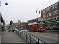
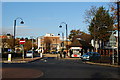
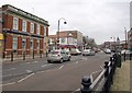
Photos of IG10 3AL

Area Information
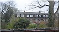
Living in IG10 3AL means inhabiting a tightly knit residential cluster in England, where 1,534 people reside across 7,448 square metres. This small area, though compact, offers a high population density of 205,964 people per square kilometre, reflecting a mature, established community. The area’s character is defined by its proximity to key transport hubs and retail centres, making daily life convenient for those prioritising accessibility. With a median age of 47 and a population skewed towards adults aged 30–64, the neighbourhood is home to a stable, long-term resident base. Most properties are owner-occupied, with houses forming the dominant accommodation type. The area’s low crime risk and absence of environmental constraints such as protected woodlands or wetlands make it a practical choice for those seeking safety and simplicity. While its size limits expansion, IG10 3AL’s integration with nearby amenities ensures a lifestyle balanced between suburban tranquillity and urban connectivity.
- Area Type
- Postcode
- Area Size
- 7448 m²
- Population
- 1534
- Population Density
- 3424 people/km²
The property market in IG10 3AL is dominated by owner-occupied homes, with 83% of residents owning their properties. This high rate of home ownership indicates a stable, long-term resident base with little reliance on rental markets. The area’s accommodation type is primarily houses, which contrasts with regions where flats or apartments predominate. Given the small size of the postcode area—7,448 square metres—and the high population density, the housing stock is limited, making the market competitive for buyers. Those considering purchases should note the compact nature of the area, which may necessitate looking at nearby regions for additional options. The dominance of owner-occupied homes suggests a community prioritising permanence, though the small size of the area may limit property diversity.
House Prices in IG10 3AL
Showing 21 properties
| Address | Type | Beds | Baths | Last Sale Price | Last Sale Date | |
|---|---|---|---|---|---|---|
| 69 Valley Hill, Loughton, IG10 3AL | Detached | 3 | 1 | £650,000 | Sep 2025 | |
| 63 Valley Hill, Loughton, IG10 3AL | Semi-detached | 4 | 2 | £800,000 | Aug 2025 | |
| 61 Valley Hill, Loughton, IG10 3AL | Semi-detached | 3 | 1 | £565,000 | Jul 2024 | |
| 58 Valley Hill, Loughton, IG10 3AL | house | - | - | £537,500 | Jan 2024 | |
| 53 Valley Hill, Loughton, IG10 3AL | Terraced | 3 | 1 | £540,000 | Dec 2023 | |
| 48 Valley Hill, Loughton, IG10 3AL | Detached | 4 | 3 | £530,000 | May 2023 | |
| 50 Valley Hill, Loughton, IG10 3AL | Semi-detached | 4 | 1 | £775,000 | Jul 2022 | |
| 59 Valley Hill, Loughton, IG10 3AL | Semi-detached | 4 | 2 | £767,500 | Jul 2022 | |
| 57 Valley Hill, Loughton, IG10 3AL | house | - | - | £705,000 | Jun 2021 | |
| 65 Valley Hill, Loughton, IG10 3AL | house | 3 | 1 | £600,000 | Mar 2021 |
Energy Efficiency in IG10 3AL
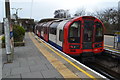
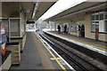
The lifestyle in IG10 3AL is shaped by its proximity to a range of amenities within practical reach. Retail options include Sainsburys Loughton, M&S Loughton SF, and Cook Loughton, offering everyday shopping convenience. Transport hubs like Loughton Underground Station and Debden Underground Station provide seamless links to the wider transport network, while rail stations such as Chingford and Ponders End support commuting. The area’s compact size ensures that amenities are accessible without long journeys. Though the data does not mention parks or leisure facilities directly, the absence of environmental constraints like protected woodlands or AONB designations suggests space for local recreational activities. The combination of retail, transport, and connectivity fosters a practical, efficient lifestyle, ideal for those valuing convenience.
Amenities
Schools
| Rank | School | Type | Entry gender | Ages |
|---|
Explore more schools in this area
Go to Schools tabDemographics
The community in IG10 3AL is predominantly composed of adults aged 30–64, with a median age of 47. This suggests a mature population, likely with established careers and family structures. Home ownership is high, with 83% of residents owning their homes, indicating a stable, long-term demographic. The area is characterised by houses rather than flats or apartments, reflecting a preference for traditional family homes. The predominant ethnic group is White, though specific diversity metrics are not provided. The population density of 205,964 people per square kilometre is exceptionally high, which may influence the character of daily life, fostering a close-knit environment. However, this density does not correlate with deprivation data, which is not available. The age profile and ownership rates suggest a community focused on stability, with limited turnover of residents.
Household Size
Accommodation Type
Tenure
Ethnic Group
Religion
Household Composition
Age
Household Deprivation
NS-SEC
Explore more demographic insights in this area
Go to Demographics tabPlanning
Planning Constraints
- Flood RiskPremium
- Ramsar Wetland SitesPremium
- Area of Outstanding Natural BeautyPremium
- Protected Nature ReservePremium
- Protected WoodlandPremium