Area Overview for IG10 2BZ
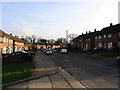
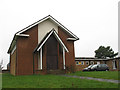
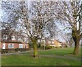
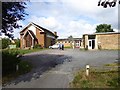
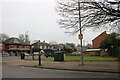
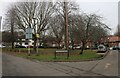
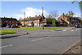
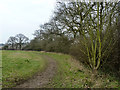
Photos of IG10 2BZ


Area Information
Living in IG10 2BZ means inhabiting a compact, densely populated residential cluster in England. The area covers just 1,425 square metres, yet it hosts 1,636 residents, resulting in a population density of 1,182 people per square kilometre. This tight-knit community is characterised by its proximity to essential services and transport links, making daily life efficient. The area’s small size fosters a sense of familiarity, though the high density may feel intimate rather than sprawling. With a median age of 47, the population skews towards adults in their 30s to 60s, suggesting a stable, family-oriented demographic. The presence of multiple schools and retail outlets within reach adds to the practicality of living here. While the area lacks natural landscapes like AONBs or protected woodlands, its urban convenience and connectivity to London’s transport network make it appealing for commuters and those prioritising accessibility over open spaces.
- Area Type
- Postcode
- Area Size
- 1425 m²
- Population
- 1636
- Population Density
- 1182 people/km²
The property market in IG10 2BZ is dominated by owner-occupied homes, with 54% of residents owning their properties. The accommodation type is predominantly houses, which suggests a focus on family-friendly living rather than apartments or flats. Given the area’s small size and high population density, the housing stock is likely limited, making it a competitive market for buyers. The concentration of houses may indicate a preference for larger, more traditional homes, which could appeal to families seeking space. However, the proximity to transport hubs and amenities may also attract investors or commuters prioritising convenience over property size. Buyers should consider the area’s compact nature and the potential for limited new developments, as the existing housing stock may not expand significantly.
House Prices in IG10 2BZ
Showing 6 properties
| Address | Type | Beds | Baths | Last Sale Price | Last Sale Date | |
|---|---|---|---|---|---|---|
| 176 Willingale Road, Loughton, IG10 2BZ | Bungalow | - | - | £258,000 | Aug 2019 | |
| 178 Willingale Road, Loughton, IG10 2BZ | Bungalow | 1 | 1 | - | - | |
| 184 Willingale Road, Loughton, IG10 2BZ | house | - | - | - | - | |
| 182 Willingale Road, Loughton, IG10 2BZ | house | - | - | - | - | |
| 180 Willingale Road, Loughton, IG10 2BZ | house | - | - | - | - | |
| 186 Willingale Road, Loughton, IG10 2BZ | Bungalow | - | - | - | - |
Energy Efficiency in IG10 2BZ
The lifestyle in IG10 2BZ is shaped by its proximity to retail, dining, and transport hubs. Local shops include Iceland Debden, M&S Chigwell BP, and Sainsburys Debden, offering a mix of grocery and general retail. The area’s transport links to multiple Underground stations and nearby airports make it easy to access London’s cultural and commercial centres. While the data does not specify parks or leisure facilities, the presence of schools and retail outlets suggests a focus on practicality over expansive recreational spaces. The compact nature of the area means amenities are within walking or short driving distance, fostering convenience. For residents prioritising accessibility and urban living, the blend of retail, transport, and educational facilities creates a functional, if limited, lifestyle environment.
Amenities
Schools
Residents of IG10 2BZ have access to a range of educational institutions, including primary schools and a high-performing academy. St John Fisher Catholic Primary School and Thomas Willingale Primary School and Nursery cater to younger children, with the latter holding an Ofsted rating of ‘good’. Debden Park High School serves both primary and secondary education, though its academy status and ‘outstanding’ Ofsted rating highlight its excellence. The presence of multiple schools within the area ensures families have options for both early education and secondary schooling. The mix of school types—traditional primary schools and a high-achieving academy—provides flexibility, allowing parents to choose between community-focused institutions and academically rigorous environments. This diversity supports varied educational needs, from religiously affiliated schools to state-funded academies.
| Rank | School | Type | Entry gender | Ages |
|---|
Explore more schools in this area
Go to Schools tabDemographics
The community in IG10 2BZ is predominantly composed of adults aged 30–64, with a median age of 47. This suggests a mature, established population, likely with strong ties to local institutions and long-term residency. Home ownership stands at 54%, indicating a mix of owner-occupied properties and rental units. The accommodation type is primarily houses, which aligns with the area’s compact layout and higher population density. The predominant ethnic group is White, reflecting a homogenous demographic profile. The high population density of 1,182 people per square kilometre means residents live in close proximity, which can enhance community interaction but may also limit personal space. This density, combined with the age profile, implies a stable, low-turnover environment where families and long-term residents form the backbone of the local economy and social fabric.
Household Size
Accommodation Type
Tenure
Ethnic Group
Religion
Household Composition
Age
Household Deprivation
NS-SEC
Explore more demographic insights in this area
Go to Demographics tabPlanning
Planning Constraints
- Flood RiskPremium
- Ramsar Wetland SitesPremium
- Area of Outstanding Natural BeautyPremium
- Protected Nature ReservePremium
- Protected WoodlandPremium