Area Overview for IG10 2DE
Photos of IG10 2DE
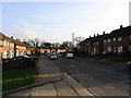
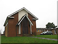
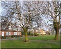
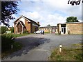

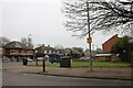
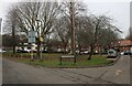
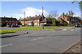
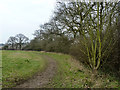

15 photos from this area
Area Information
Key information about the IG10 2DE including its size, population, and administrative classification.
- Area Type
- Postcode
- Area Size
- 1.7 hectares
- Population
- 1528
- Population Density
- 3778 people/km²
House Prices in IG10 2DE
57
Properties
£240,792
Average Sold Price
£41,750
Lowest Price
£457,500
Highest Price
Showing 57 properties
| Address | Type | Beds | Baths | Last Sale Price | Last Sale Date | |
|---|---|---|---|---|---|---|
| 185 Willingale Road, Loughton, IG10 2DE | Flat | 1 | 1 | £215,000 | Mar 2025 | |
| 151 Willingale Road, Loughton, IG10 2DE | Terraced | 3 | 1 | £457,500 | Dec 2023 | |
| 125 Willingale Road, Loughton, IG10 2DE | Maisonette | 1 | 1 | £300,000 | Jul 2023 | |
| 147 Willingale Road, Loughton, IG10 2DE | house | - | - | £395,000 | Apr 2021 | |
| 221 Willingale Road, Loughton, IG10 2DE | Flat | - | - | £253,000 | Feb 2021 | |
| 129 Willingale Road, Loughton, IG10 2DE | Flat | 1 | 1 | £253,000 | Sep 2020 | |
| 205 Willingale Road, Loughton, IG10 2DE | Flat | - | - | £271,500 | Apr 2018 | |
| 223 Willingale Road, Loughton, IG10 2DE | Flat | - | - | £277,500 | Feb 2018 | |
| 141 Willingale Road, Loughton, IG10 2DE | house | - | - | £375,000 | Mar 2016 | |
| 171 Willingale Road, Loughton, IG10 2DE | Semi-detached | - | - | £200,000 | Nov 2013 |
Page 1 of 6
Energy Efficiency in IG10 2DE
Amenities
Schools
| Rank | School | Type | Entry gender | Ages |
|---|
Explore more schools in this area
Go to Schools tabDemographics
Household Size
Family (3-5 people)
most common
Accommodation Type
Houses
most common
Tenure
51
majority
Ethnic Group
White
most common
Religion
N/A
most common
Household Composition
N/A
most common
Age
47
median
Adults (30-64 years)
most common
Household Deprivation
N/A
with no deprivation
NS-SEC
32
in Lower managerial occupations
Explore more demographic insights in this area
Go to Demographics tabPlanning
Planning Constraints
- Flood RiskPremium
- Ramsar Wetland SitesPremium
- Area of Outstanding Natural BeautyPremium
- Protected Nature ReservePremium
- Protected WoodlandPremium