Area Overview for IG10 2AF
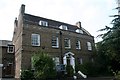
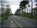
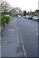
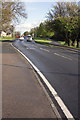
Photos of IG10 2AF


Area Information
Living in IG10 2AF means inhabiting a compact, densely populated residential cluster in England. The area covers 5,393 square metres and is home to 1,539 residents, making it one of the most densely populated places in the country at 285,396 people per square kilometre. This small postcode area is characterised by its proximity to transport networks and local amenities, catering to a community predominantly aged 30–64. Daily life here is shaped by the balance between residential tranquillity and easy access to nearby services. The area’s small size means residents are likely to know their neighbours, though the high population density can influence the pace of life. With no major natural constraints or environmental risks, IG10 2AF offers a practical, no-frills living environment. Its appeal lies in its connectivity to surrounding towns and the presence of essential retail and transport hubs within walking or short driving distance. For those prioritising convenience over space, this area provides a functional base for commuting and everyday needs.
- Area Type
- Postcode
- Area Size
- 5393 m²
- Population
- 1539
- Population Density
- 6683 people/km²
The property market in IG10 2AF is dominated by owner-occupied homes, with 64% of residents owning their properties. This suggests a stable, settled community rather than a transient rental market. The accommodation type is primarily houses, which may indicate a preference for family homes or larger living spaces. Given the area’s small size and high population density, the housing stock is likely limited, making it a niche market for buyers seeking proximity to transport and amenities. The compact nature of the postcode means properties are likely to be closely spaced, with little scope for new development. Buyers should consider the area’s proximity to nearby towns and transport hubs, which may offset the lack of local expansion. For those prioritising convenience over space, IG10 2AF offers a practical option, though the limited size of the area may restrict property choice.
House Prices in IG10 2AF
Showing 12 properties
| Address | Type | Beds | Baths | Last Sale Price | Last Sale Date | |
|---|---|---|---|---|---|---|
| 19 Westall Road, Loughton, IG10 2AF | Terraced | 3 | 1 | £393,000 | Jun 2020 | |
| 15 Westall Road, Loughton, IG10 2AF | Terraced | 2 | 2 | £390,000 | Jan 2017 | |
| 3 Westall Road, Loughton, IG10 2AF | Terraced | 3 | 1 | £355,000 | Sep 2015 | |
| 7 Westall Road, Loughton, IG10 2AF | Semi-detached | 3 | - | £267,000 | Apr 2013 | |
| 5 Westall Road, Loughton, IG10 2AF | house | - | - | £229,000 | Jan 2013 | |
| 11 Westall Road, Loughton, IG10 2AF | house | - | - | £205,000 | Mar 2010 | |
| 21 Westall Road, Loughton, IG10 2AF | Terraced | - | - | £78,000 | Jul 1998 | |
| 17 Westall Road, Loughton, IG10 2AF | house | - | - | - | - | |
| 13 Westall Road, Loughton, IG10 2AF | Terraced | - | - | - | - | |
| 1 Westall Road, Loughton, IG10 2AF | Bungalow | - | - | - | - |
Energy Efficiency in IG10 2AF
Residents of IG10 2AF have access to a range of nearby amenities that support daily life. Retail options include Iceland in Debden, M&S at Chigwell BP, and Sainsburys in Debden, providing essential shopping and grocery needs. The area’s transport links are complemented by proximity to multiple underground and rail stations, ensuring easy access to workplaces, leisure spots, and services. While the data does not specify parks or recreational areas, the presence of nearby stations suggests opportunities for walking or cycling in surrounding green spaces. The nearby North Weald Airport, though not a major destination, may offer convenience for occasional travel. The compact nature of the area means amenities are within practical reach, fostering a lifestyle that balances convenience with the need for nearby connectivity.
Amenities
Schools
| Rank | School | Type | Entry gender | Ages |
|---|
Explore more schools in this area
Go to Schools tabDemographics
The community in IG10 2AF is predominantly middle-aged, with a median age of 47 and the most common age range being adults aged 30–64. Home ownership is strong, with 64% of residents owning their homes, indicating a stable, long-term population. The accommodation type is primarily houses, reflecting a focus on family-oriented living. The predominant ethnic group is White, though the data does not specify further diversity metrics. The high population density of 285,396 people per square kilometre suggests a compact, closely knit community. This density may influence local dynamics, such as shared resources or community interaction, but it also means limited space for expansion. The absence of detailed deprivation data means the area’s quality of life remains unquantified, though the presence of essential amenities and transport links suggests a functional, if modest, standard of living.
Household Size
Accommodation Type
Tenure
Ethnic Group
Religion
Household Composition
Age
Household Deprivation
NS-SEC
Explore more demographic insights in this area
Go to Demographics tabPlanning
Planning Constraints
- Flood RiskPremium
- Ramsar Wetland SitesPremium
- Area of Outstanding Natural BeautyPremium
- Protected Nature ReservePremium
- Protected WoodlandPremium