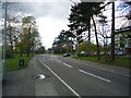
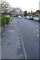
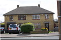
Area Overview for IG10 2AB
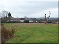
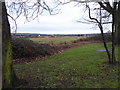
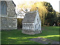
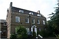
Photos of IG10 2AB


Area Information
Living in IG10 2AB means inhabiting a small, densely populated residential cluster in England. The area covers just 7,108 square metres, yet it accommodates 1,539 residents, resulting in a population density of 216,509 people per square kilometre. This compact footprint suggests a tightly knit community, where proximity to amenities and services is a defining feature. The median age of 47 indicates a mature demographic, with adults aged 30–64 forming the largest age group. This suggests a stable, established population, likely with long-term ties to the area. The high home ownership rate of 64% reinforces a sense of permanence, with houses being the predominant type of accommodation. While the area lacks natural or protected landscapes, its strategic location near transport hubs and retail centres offers practical convenience. For those seeking a quiet yet connected lifestyle, IG10 2AB balances density with accessibility, though its small size means every decision about living here is closely tied to its immediate surroundings.
- Area Type
- Postcode
- Area Size
- 7108 m²
- Population
- 1539
- Population Density
- 6683 people/km²
The property market in IG10 2AB is defined by high home ownership (64%) and a focus on houses rather than flats or apartments. This suggests a market skewed towards owner-occupied properties, which may appeal to families or individuals seeking stability. The predominance of houses indicates a likely mix of semi-detached, detached, or terraced homes, typical of suburban or commuter areas. Given the area’s small size, the housing stock is limited, meaning buyers must consider nearby zones for more options. The high home ownership rate implies strong demand for existing properties, potentially limiting availability for new buyers. However, the lack of planning constraints such as protected woodlands or AONB designations may make it easier to develop or renovate properties. For those prioritising a traditional, settled lifestyle, IG10 2AB’s housing profile offers a clear advantage, though its compact nature means the market is unlikely to be expansive.
House Prices in IG10 2AB
Showing 20 properties
| Address | Type | Beds | Baths | Last Sale Price | Last Sale Date | |
|---|---|---|---|---|---|---|
| 11 Conyers Way, Loughton, IG10 2AB | Semi-detached | 3 | - | £520,000 | Feb 2022 | |
| 24 Conyers Way, Loughton, IG10 2AB | house | - | - | £390,000 | Nov 2018 | |
| 14 Conyers Way, Loughton, IG10 2AB | house | - | - | £365,000 | Apr 2017 | |
| 27 Conyers Way, Loughton, IG10 2AB | house | - | - | £337,000 | Oct 2016 | |
| 13 Conyers Way, Loughton, IG10 2AB | house | - | - | £295,000 | Jul 2015 | |
| 18 Conyers Way, Loughton, IG10 2AB | Semi-detached | - | - | £140,000 | Jan 2005 | |
| 23 Conyers Way, Loughton, IG10 2AB | Semi-detached | 4 | 1 | £176,500 | Jan 2005 | |
| 16 Conyers Way, Loughton, IG10 2AB | Semi-detached | - | - | £140,000 | Sep 2004 | |
| 17 Conyers Way, Loughton, IG10 2AB | Semi-detached | - | - | £127,500 | Mar 2002 | |
| 33 Conyers Way, Loughton, IG10 2AB | Semi-detached | 4 | 4 | £52,000 | Jul 1996 |
Energy Efficiency in IG10 2AB
Residents of IG10 2AB have access to a range of amenities within practical reach. Retail options include Iceland Debden, M&S Chigwell BP, and Sainsburys Debden, providing everyday shopping needs. Transport is well-served by five nearby underground stations, including Debden and Loughton, plus rail services at Chingford and Highams Park. A bus interchange at Whipps Cross offers additional connectivity. While the area lacks major leisure or cultural venues, its proximity to transport links means residents can easily access larger hubs like London. The presence of multiple retail and transport points suggests a functional, convenience-driven lifestyle. However, the absence of detailed information about parks, dining, or recreational facilities means the area’s character beyond practicality remains less defined. For those prioritising accessibility over scenic or cultural amenities, IG10 2AB delivers a straightforward, efficient daily life.
Amenities
Schools
| Rank | School | Type | Entry gender | Ages |
|---|
Explore more schools in this area
Go to Schools tabDemographics
The community in IG10 2AB is predominantly composed of adults aged 30–64, with a median age of 47. This suggests a mature, settled population, likely with established careers and family structures. Home ownership is high at 64%, indicating a strong presence of long-term residents rather than transient renters. The area is characterised by houses, which contrasts with regions where flats or apartments dominate. The predominant ethnic group is White, reflecting a demographic profile typical of many suburban or commuter areas in England. The high population density of 216,509 people per square kilometre raises questions about living space and community dynamics, though the data does not specify deprivation levels. This density may influence local services and infrastructure demands, but it also fosters a close-knit environment where residents are likely to know their neighbours. The absence of detailed diversity statistics means the community’s full composition remains partially unexplored.
Household Size
Accommodation Type
Tenure
Ethnic Group
Religion
Household Composition
Age
Household Deprivation
NS-SEC
Explore more demographic insights in this area
Go to Demographics tabPlanning
Planning Constraints
- Flood RiskPremium
- Ramsar Wetland SitesPremium
- Area of Outstanding Natural BeautyPremium
- Protected Nature ReservePremium
- Protected WoodlandPremium