Area Overview for IG10 1EG
Photos of IG10 1EG
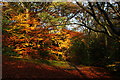
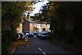
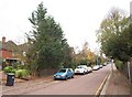
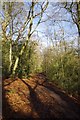
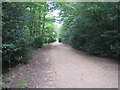
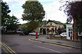
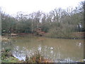
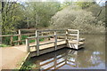
80 photos from this area
Area Information
Key information about the IG10 1EG including its size, population, and administrative classification.
- Area Type
- Postcode
- Area Size
- 9772 m²
- Population
- 1540
- Population Density
- 1448 people/km²
House Prices in IG10 1EG
44
Properties
£408,360
Average Sold Price
£120,000
Lowest Price
£905,600
Highest Price
Showing 44 properties
| Address | Type | Beds | Baths | Last Sale Price | Last Sale Date | |
|---|---|---|---|---|---|---|
| 156 Forest Road, Loughton, IG10 1EG | Semi-detached | 3 | 1 | £612,100 | Nov 2024 | |
| 160 Forest Road, Loughton, IG10 1EG | Detached | 2 | 1 | £905,600 | Jul 2024 | |
| 128 Forest Road, Loughton, IG10 1EG | Terraced | 3 | 1 | £510,000 | Feb 2022 | |
| 98 Forest Road, Loughton, IG10 1EG | Terraced | 5 | 3 | £350,000 | Jun 2021 | |
| 172 Forest Road, Loughton, IG10 1EG | Terraced | 2 | 2 | £550,000 | May 2021 | |
| 176 Forest Road, Loughton, IG10 1EG | house | - | - | £540,000 | Nov 2020 | |
| 132 Forest Road, Loughton, IG10 1EG | Terraced | 3 | 1 | £463,000 | Sep 2020 | |
| Thumpington Cottage, 140 Forest Road, Loughton, IG10 1EG | Terraced | 3 | 1 | £440,000 | Jul 2019 | |
| 126 Forest Road, Loughton, IG10 1EG | Cottage | 2 | 1 | £500,000 | Jun 2019 | |
| 154 Forest Road, Loughton, IG10 1EG | house | - | - | £480,000 | Aug 2017 |
Page 1 of 5
Energy Efficiency in IG10 1EG
Amenities
Schools
| Rank | School | Type | Entry gender | Ages |
|---|
Explore more schools in this area
Go to Schools tabDemographics
Household Size
Family (3-5 people)
most common
Accommodation Type
Houses
most common
Tenure
82
majority
Ethnic Group
White
most common
Religion
N/A
most common
Household Composition
N/A
most common
Age
47
median
Adults (30-64 years)
most common
Household Deprivation
N/A
with no deprivation
NS-SEC
55
in Lower managerial occupations
Explore more demographic insights in this area
Go to Demographics tabPlanning
Planning Constraints
- Flood RiskPremium
- Ramsar Wetland SitesPremium
- Area of Outstanding Natural BeautyPremium
- Protected Nature ReservePremium
- Protected WoodlandPremium