Area Overview for IG10 4AA
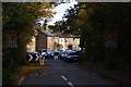
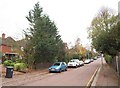
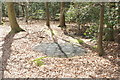
Photos of IG10 4AA


Area Information
Living in IG10 4AA means inhabiting a small, tightly knit residential cluster in England, where 1,598 people reside across 71.8 hectares. The area’s compact size fosters a sense of familiarity, with homes predominantly in single-family dwellings. The median age of 47 suggests a mature population, many of whom are in their prime working years. This postcode is served by multiple transport hubs, including Loughton Underground Station and several rail stops, linking residents to London and surrounding areas. Retail options like Morrisons Loughton and M&S Loughton SF offer convenience, while the proximity to protected woodlands and nature reserves adds a layer of environmental significance. Daily life balances suburban comfort with access to natural spaces, though the area’s small footprint means residents often look beyond its borders for broader amenities. The high home ownership rate of 87% reflects a stable, long-term community, with most properties being owner-occupied. For buyers, IG10 4AA presents a mix of practicality and quiet living, though its limited size means careful consideration of nearby areas is essential.
- Area Type
- Postcode
- Area Size
- 71.8 hectares
- Population
- 1598
- Population Density
- 484 people/km²
The property market in IG10 4AA is characterised by high home ownership—87% of residents own their homes—and a predominance of houses over flats. This suggests a market oriented toward owner-occupiers rather than renters, with properties likely designed for families or individuals seeking private, spacious living. The small area size means the housing stock is limited, requiring buyers to consider nearby postcodes for additional options. The concentration of houses implies a focus on traditional, possibly older properties, which may appeal to those prioritising security and permanence. However, the limited scale of the area could mean fewer choices in terms of property types or price ranges. For buyers, this suggests a niche market where demand may be strong among those seeking established, low-maintenance homes. The high ownership rate also indicates a community with long-term residents, which can be a factor in property value stability.
House Prices in IG10 4AA
Showing 7 properties
| Address | Type | Beds | Baths | Last Sale Price | Last Sale Date | |
|---|---|---|---|---|---|---|
| Robin Hood Cottage, Epping New Road, Loughton, IG10 4AA | house | 3 | - | £420,000 | Jul 2012 | |
| 1, West Lodge, Epping New Road, Loughton, IG10 4AA | house | - | - | - | - | |
| 2, West Lodge, Epping New Road, Loughton, IG10 4AA | house | - | - | - | - | |
| The Robin Hood Public House, Epping New Road, Loughton, IG10 4AA | restaurant_cafe | - | - | - | - | |
| Connaught Farm Nurseries, Epping New Road, Buckhurst Hill, IG10 4AA | Farm | - | - | - | - | |
| Robin Hood Hotel, Epping New Road, Loughton, IG10 4AA | hotel | - | - | - | - | |
| Flat, The Robin Hood Public House, Epping New Road, Loughton, IG10 4AA | Flat | - | - | - | - |
Energy Efficiency in IG10 4AA
Residents of IG10 4AA have access to a range of amenities within practical reach. Retail options include Morrisons Loughton, Cook Loughton, and M&S Loughton SF, offering everyday shopping needs. The area’s transport hubs, such as Loughton Underground Station and Debden Rail Station, provide easy access to London and surrounding towns, while Whipps Cross Bus Interchange connects to local services. Although specific parks or leisure facilities are not detailed in the data, the presence of protected woodlands and nature reserves suggests nearby green spaces for recreation. The combination of retail, transport, and natural environments supports a balanced lifestyle, with convenience for shopping, commuting, and outdoor activities. The area’s compact size means residents often rely on nearby postcodes for broader amenities, but the existing infrastructure ensures daily life remains efficient and accessible.
Amenities
Schools
| Rank | School | Type | Entry gender | Ages |
|---|
Explore more schools in this area
Go to Schools tabDemographics
The population of IG10 4AA is 1,598, with a density of 484 people per square kilometre, indicating a moderately populated residential area. The median age of 47 and the most common age range of 30–64 years suggest a community skewed toward middle-aged adults, likely established professionals or families. Home ownership is high at 87%, with the majority of properties being houses rather than flats, reflecting a preference for private, spacious living. The predominant ethnic group is White, though no specific diversity statistics are provided. The population density, while not excessively high, means residents may experience a mix of communal and private spaces. This demographic profile implies a stable, low-turnover area where long-term residency is common. The absence of detailed data on deprivation or income levels means quality of life can only be inferred from the available figures, such as the high home ownership rate, which often correlates with economic stability.
Household Size
Accommodation Type
Tenure
Ethnic Group
Religion
Household Composition
Age
Household Deprivation
NS-SEC
Explore more demographic insights in this area
Go to Demographics tabPlanning
Planning Constraints
- Flood RiskPremium
- Ramsar Wetland SitesPremium
- Area of Outstanding Natural BeautyPremium
- Protected Nature ReservePremium
- Protected WoodlandPremium