Area Overview for HP4 3JG
Photos of HP4 3JG
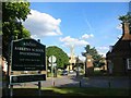
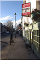
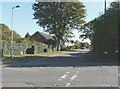
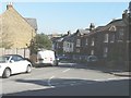
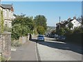
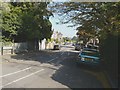
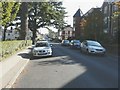
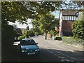
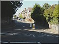
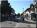
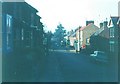
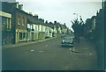
53 photos from this area
Area Information
Key information about the HP4 3JG including its size, population, and administrative classification.
- Area Type
- Postcode
- Area Size
- 7456 m²
- Population
- 1681
- Population Density
- 4568 people/km²
House Prices in HP4 3JG
30
Properties
£479,010
Average Sold Price
£62,500
Lowest Price
£848,500
Highest Price
Showing 30 properties
| Address | Type | Beds | Baths | Last Sale Price | Last Sale Date | |
|---|---|---|---|---|---|---|
| 83 Shrublands Avenue, Berkhamsted, HP4 3JG | Detached | 3 | 2 | £825,000 | Sep 2025 | |
| 81 Shrublands Avenue, Berkhamsted, HP4 3JG | Terraced | 4 | 1 | £848,500 | Nov 2024 | |
| 79 Shrublands Avenue, Berkhamsted, HP4 3JG | Terraced | 3 | 1 | £750,000 | Oct 2024 | |
| 70 Shrublands Avenue, Berkhamsted, HP4 3JG | Terraced | 3 | 1 | £800,000 | Dec 2023 | |
| 71 Shrublands Avenue, Berkhamsted, HP4 3JG | Terraced | 3 | 1 | £740,000 | Jul 2023 | |
| 88 Shrublands Avenue, Berkhamsted, HP4 3JG | house | 3 | 1 | £650,000 | Dec 2022 | |
| 75 Shrublands Avenue, Berkhamsted, HP4 3JG | house | - | - | £712,000 | Nov 2022 | |
| 86 Shrublands Avenue, Berkhamsted, HP4 3JG | house | 3 | 1 | £755,000 | Feb 2022 | |
| 80 Shrublands Avenue, Berkhamsted, HP4 3JG | house | 3 | - | £640,000 | Nov 2020 | |
| 77 Shrublands Avenue, Berkhamsted, HP4 3JG | Terraced | 4 | 2 | £736,500 | Jun 2019 |
Page 1 of 3
Energy Efficiency in HP4 3JG
Amenities
Schools
| Rank | School | Type | Entry gender | Ages |
|---|
Explore more schools in this area
Go to Schools tabDemographics
Household Size
One person
most common
Accommodation Type
Houses
most common
Tenure
67
majority
Ethnic Group
White
most common
Religion
N/A
most common
Household Composition
N/A
most common
Age
47
median
Adults (30-64 years)
most common
Household Deprivation
N/A
with no deprivation
NS-SEC
54
in Lower managerial occupations
Explore more demographic insights in this area
Go to Demographics tabPlanning
Planning Constraints
- Flood RiskPremium
- Ramsar Wetland SitesPremium
- Area of Outstanding Natural BeautyPremium
- Protected Nature ReservePremium
- Protected WoodlandPremium