Area Overview for HP4 1HH
Photos of HP4 1HH
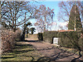
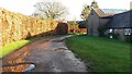
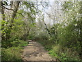
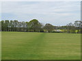

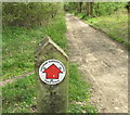
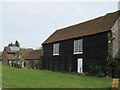
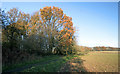
13 photos from this area
Area Information
Key information about the HP4 1HH including its size, population, and administrative classification.
- Area Type
- Postcode
- Area Size
- 27.3 hectares
- Population
- 1481
- Population Density
- 103 people/km²
House Prices in HP4 1HH
12
Properties
£836,714
Average Sold Price
£103,000
Lowest Price
£1,980,000
Highest Price
Showing 12 properties
| Address | Type | Beds | Baths | Last Sale Price | Last Sale Date | |
|---|---|---|---|---|---|---|
| 4, Castle Hill Farm Cottages, Castle Hill, Berkhamsted, HP4 1HH | house | 3 | 1 | £861,000 | Oct 2025 | |
| Dutch Barn, Castle Hill, Berkhamsted, HP4 1HH | house | - | - | £743,000 | Sep 2017 | |
| The Lodge, Castle Hill, Berkhamsted, HP4 1HH | house | - | - | £1,100,000 | Jun 2016 | |
| The Stables, Castle Hill, Berkhamsted, HP4 1HH | Detached | - | - | £245,000 | Oct 2013 | |
| The Great Barn, Castle Hill, Berkhamsted, HP4 1HH | Semi-detached | 6 | - | £1,980,000 | Aug 2013 | |
| The Old Barn, Castle Hill, Berkhamsted, HP4 1HH | Terraced | - | - | £825,000 | Jun 2012 | |
| 3, Castle Hill Farm Cottages, Castle Hill, Berkhamsted, HP4 1HH | Semi-detached | 6 | 6 | £103,000 | Aug 1996 | |
| 2, Castle Hill Farm Cottages, Castle Hill, Berkhamsted, HP4 1HH | undefined | - | - | - | - | |
| CASTLE HILL FARM COTTAGES, CASTLE HILL, Berkhamsted, HP4 1HH | Detached | 4 | 2 | - | - | |
| 1-2, Castle Hill Farm Cottages, Castle Hill, Berkhamsted, HP4 1HH | Detached | - | - | - | - |
Page 1 of 2
Energy Efficiency in HP4 1HH
Amenities
Schools
| Rank | School | Type | Entry gender | Ages |
|---|
Explore more schools in this area
Go to Schools tabDemographics
Household Size
Two person
most common
Accommodation Type
Houses
most common
Tenure
89
majority
Ethnic Group
White
most common
Religion
N/A
most common
Household Composition
N/A
most common
Age
47
median
Adults (30-64 years)
most common
Household Deprivation
N/A
with no deprivation
NS-SEC
48
in Lower managerial occupations
Explore more demographic insights in this area
Go to Demographics tabPlanning
Planning Constraints
- Flood RiskPremium
- Ramsar Wetland SitesPremium
- Area of Outstanding Natural BeautyPremium
- Protected Nature ReservePremium
- Protected WoodlandPremium