Area Overview for HP4 1LR
Photos of HP4 1LR
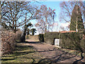
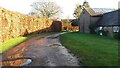
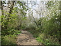
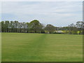

13 photos from this area
Area Information
Key information about the HP4 1LR including its size, population, and administrative classification.
- Area Type
- Postcode
- Area Size
- 1.2 km²
- Population
- 1481
- Population Density
- 103 people/km²
House Prices in HP4 1LR
38
Properties
£875,374
Average Sold Price
£190,000
Lowest Price
£1,420,000
Highest Price
Showing 38 properties
| Address | Type | Beds | Baths | Last Sale Price | Last Sale Date | |
|---|---|---|---|---|---|---|
| The Croft, Northchurch Common, Berkhamsted, HP4 1LR | Bungalow | 5 | 3 | £1,141,360 | Jan 2025 | |
| Highfield, Northchurch Common, Berkhamsted, HP4 1LR | Retail | 4 | 2 | £1,420,000 | Oct 2022 | |
| Brackenhurst, Northchurch Common, Berkhamsted, HP4 1LR | Bungalow | - | - | £1,340,000 | Sep 2021 | |
| Wrenthorpe, Northchurch Common, Berkhamsted, HP4 1LR | Detached | 4 | 2 | £1,027,500 | Mar 2020 | |
| Brimbles, Northchurch Common, Berkhamsted, HP4 1LR | Bungalow | - | - | £1,000,000 | Oct 2018 | |
| Chestnut Lodge, Northchurch Common, Berkhamsted, HP4 1LR | Bungalow | 3 | 1 | £1,100,000 | Jul 2015 | |
| Rosemont, Northchurch Common, Berkhamsted, HP4 1LR | Detached | - | - | £902,500 | Nov 2013 | |
| Ivy Todd, Northchurch Common, Berkhamsted, HP4 1LR | house | 3 | - | £725,000 | Oct 2012 | |
| Greenacre, Northchurch Common, Berkhamsted, HP4 1LR | house | 4 | - | £920,000 | Oct 2010 | |
| Overdene, Northchurch Common, Berkhamsted, HP4 1LR | Detached | - | - | £950,000 | Mar 2009 |
Page 1 of 4
Energy Efficiency in HP4 1LR
Amenities
Schools
| Rank | School | Type | Entry gender | Ages |
|---|
Explore more schools in this area
Go to Schools tabDemographics
Household Size
Two person
most common
Accommodation Type
Houses
most common
Tenure
89
majority
Ethnic Group
White
most common
Religion
N/A
most common
Household Composition
N/A
most common
Age
47
median
Adults (30-64 years)
most common
Household Deprivation
N/A
with no deprivation
NS-SEC
48
in Lower managerial occupations
Explore more demographic insights in this area
Go to Demographics tabPlanning
Planning Constraints
- Flood RiskPremium
- Ramsar Wetland SitesPremium
- Area of Outstanding Natural BeautyPremium
- Protected Nature ReservePremium
- Protected WoodlandPremium