Area Overview for HP23 5BU
Photos of HP23 5BU


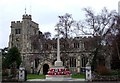
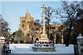
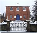
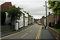
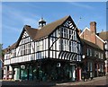
100 photos from this area
Area Information
Key information about the HP23 5BU including its size, population, and administrative classification.
- Area Type
- Postcode
- Area Size
- 1.2 hectares
- Population
- 1527
- Population Density
- 4053 people/km²
House Prices in HP23 5BU
24
Properties
£533,159
Average Sold Price
£375,000
Lowest Price
£780,000
Highest Price
Showing 24 properties
| Address | Type | Beds | Baths | Last Sale Price | Last Sale Date | |
|---|---|---|---|---|---|---|
| 57 Dundale Road, Tring, HP23 5BU | Detached | 3 | 1 | £607,500 | Apr 2025 | |
| 56 Dundale Road, Tring, HP23 5BU | house | 4 | 2 | £780,000 | Oct 2023 | |
| 58 Dundale Road, Tring, HP23 5BU | house | - | - | £680,000 | Nov 2019 | |
| 51 Dundale Road, Tring, HP23 5BU | Detached | 4 | 2 | £480,000 | Jul 2018 | |
| 47 Dundale Road, Tring, HP23 5BU | Bungalow | - | - | £650,000 | Jun 2016 | |
| 60 Dundale Road, Tring, HP23 5BU | Detached | 3 | - | £427,300 | May 2014 | |
| 49 Dundale Road, Tring, HP23 5BU | Bungalow | 3 | 2 | £380,000 | Jan 2014 | |
| 55 Dundale Road, Tring, HP23 5BU | Detached | 4 | 3 | £485,000 | Apr 2013 | |
| 53 Dundale Road, Tring, HP23 5BU | Bungalow | - | - | £375,000 | Feb 2012 | |
| 59 Dundale Road, Tring, HP23 5BU | house | - | - | £600,000 | Dec 2011 |
Page 1 of 3
Energy Efficiency in HP23 5BU
Amenities
Schools
| Rank | School | Type | Entry gender | Ages |
|---|
Explore more schools in this area
Go to Schools tabDemographics
Household Size
Family (3-5 people)
most common
Accommodation Type
Houses
most common
Tenure
78
majority
Ethnic Group
White
most common
Religion
N/A
most common
Household Composition
N/A
most common
Age
47
median
Adults (30-64 years)
most common
Household Deprivation
N/A
with no deprivation
NS-SEC
46
in Lower managerial occupations
Explore more demographic insights in this area
Go to Demographics tabPlanning
Planning Constraints
- Flood RiskPremium
- Ramsar Wetland SitesPremium
- Area of Outstanding Natural BeautyPremium
- Protected Nature ReservePremium
- Protected WoodlandPremium