Area Overview for HP23 4HT
Photos of HP23 4HT
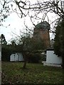
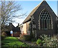
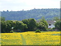
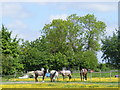
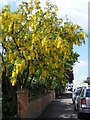
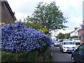
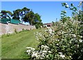

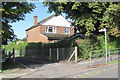
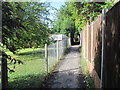
94 photos from this area
Area Information
Key information about the HP23 4HT including its size, population, and administrative classification.
- Area Type
- Postcode
- Area Size
- 2.0 hectares
- Population
- 1527
- Population Density
- 4053 people/km²
House Prices in HP23 4HT
24
Properties
£745,722
Average Sold Price
£205,000
Lowest Price
£1,125,000
Highest Price
Showing 24 properties
| Address | Type | Beds | Baths | Last Sale Price | Last Sale Date | |
|---|---|---|---|---|---|---|
| Ashcroft, Bunstrux, Tring, HP23 4HT | Detached | 4 | 2 | £1,125,000 | Oct 2023 | |
| Glendene, Bunstrux, Tring, HP23 4HT | house | 3 | 3 | £1,050,000 | Sep 2023 | |
| Roughways, Bunstrux, Tring, HP23 4HT | Detached | 4 | 3 | £830,000 | Sep 2020 | |
| Lesanor, Bunstrux, Tring, HP23 4HT | house | - | - | £700,000 | Jul 2020 | |
| Threejays, Bunstrux, Tring, HP23 4HT | house | - | - | £832,500 | Feb 2020 | |
| Beverleigh, Bunstrux, Tring, HP23 4HT | Detached | 5 | 3 | £955,000 | Jan 2020 | |
| Whitecrest, Bunstrux, Tring, HP23 4HT | Detached | - | - | £890,000 | May 2017 | |
| Greencroft House, Bunstrux, Tring, HP23 4HT | house | - | - | £900,000 | Nov 2015 | |
| Pine Trees, Bunstrux, Tring, HP23 4HT | house | - | - | £980,000 | Jul 2015 | |
| Linden Orchard, Bunstrux, Tring, HP23 4HT | Detached | - | - | £690,000 | Apr 2013 |
Page 1 of 3
Energy Efficiency in HP23 4HT
Amenities
Schools
| Rank | School | Type | Entry gender | Ages |
|---|
Explore more schools in this area
Go to Schools tabDemographics
Household Size
Family (3-5 people)
most common
Accommodation Type
Houses
most common
Tenure
78
majority
Ethnic Group
White
most common
Religion
N/A
most common
Household Composition
N/A
most common
Age
47
median
Adults (30-64 years)
most common
Household Deprivation
N/A
with no deprivation
NS-SEC
46
in Lower managerial occupations
Explore more demographic insights in this area
Go to Demographics tabPlanning
Planning Constraints
- Flood RiskPremium
- Ramsar Wetland SitesPremium
- Area of Outstanding Natural BeautyPremium
- Protected Nature ReservePremium
- Protected WoodlandPremium