Area Overview for HP23 4DN
Photos of HP23 4DN
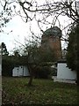
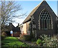
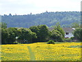
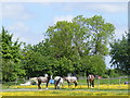
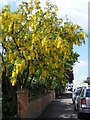
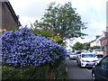

94 photos from this area
Area Information
Key information about the HP23 4DN including its size, population, and administrative classification.
- Area Type
- Postcode
- Area Size
- 1.6 hectares
- Population
- 1472
- Population Density
- 693 people/km²
House Prices in HP23 4DN
19
Properties
£448,450
Average Sold Price
£146,500
Lowest Price
£675,000
Highest Price
Showing 19 properties
| Address | Type | Beds | Baths | Last Sale Price | Last Sale Date | |
|---|---|---|---|---|---|---|
| 10 Longfield Gardens, Tring, HP23 4DN | Bungalow | 3 | 2 | £675,000 | May 2022 | |
| 13 Longfield Gardens, Tring, HP23 4DN | Bungalow | - | - | £500,000 | Sep 2021 | |
| 18 Longfield Gardens, Tring, HP23 4DN | Detached | 4 | 2 | £620,000 | Feb 2021 | |
| 8 Longfield Gardens, Tring, HP23 4DN | Semi-detached | 2 | 1 | £465,000 | Mar 2018 | |
| 2 Longfield Gardens, Tring, HP23 4DN | Semi-detached | 3 | 1 | £415,000 | Oct 2016 | |
| 4 Longfield Gardens, Tring, HP23 4DN | Detached | 4 | 2 | £640,000 | Oct 2016 | |
| 16 Longfield Gardens, Tring, HP23 4DN | Bungalow | 2 | 1 | £360,000 | Oct 2015 | |
| 14 Longfield Gardens, Tring, HP23 4DN | Bungalow | 2 | - | £350,000 | Jul 2014 | |
| 3 Longfield Gardens, Tring, HP23 4DN | Semi-detached | - | - | £313,000 | Aug 2007 | |
| 19 Longfield Gardens, Tring, HP23 4DN | Detached | - | - | £146,500 | Jan 1997 |
Page 1 of 2
Energy Efficiency in HP23 4DN
Amenities
Schools
| Rank | School | Type | Entry gender | Ages |
|---|
Explore more schools in this area
Go to Schools tabDemographics
Household Size
Family (3-5 people)
most common
Accommodation Type
Houses
most common
Tenure
82
majority
Ethnic Group
White
most common
Religion
N/A
most common
Household Composition
N/A
most common
Age
47
median
Adults (30-64 years)
most common
Household Deprivation
N/A
with no deprivation
NS-SEC
46
in Lower managerial occupations
Explore more demographic insights in this area
Go to Demographics tabPlanning
Planning Constraints
- Flood RiskPremium
- Ramsar Wetland SitesPremium
- Area of Outstanding Natural BeautyPremium
- Protected Nature ReservePremium
- Protected WoodlandPremium