Area Overview for HP23 4DG
Photos of HP23 4DG
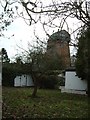
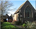
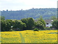
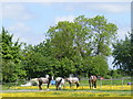
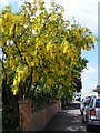
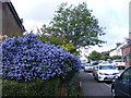

94 photos from this area
Area Information
Key information about the HP23 4DG including its size, population, and administrative classification.
- Area Type
- Postcode
- Area Size
- 1.3 hectares
- Population
- Not available
- Population Density
- Not available
House Prices in HP23 4DG
35
Properties
£464,713
Average Sold Price
£185,000
Lowest Price
£725,000
Highest Price
Showing 35 properties
| Address | Type | Beds | Baths | Last Sale Price | Last Sale Date | |
|---|---|---|---|---|---|---|
| 30 Longfield Road, Tring, HP23 4DG | Detached | 3 | 2 | £685,000 | May 2025 | |
| 16A Longfield Road, Tring, HP23 4DG | Detached | 3 | 1 | £485,000 | Mar 2025 | |
| 24 Longfield Road, Tring, HP23 4DG | Semi-detached | 4 | 2 | £725,000 | Dec 2024 | |
| 23 Longfield Road, Tring, HP23 4DG | Semi-detached | 3 | 1 | £590,000 | Dec 2024 | |
| 46 Longfield Road, Tring, HP23 4DG | Bungalow | 4 | 2 | £670,000 | Mar 2024 | |
| 13 Longfield Road, Tring, HP23 4DG | Semi-detached | 3 | 1 | £580,000 | Feb 2023 | |
| 21 Longfield Road, Tring, HP23 4DG | Semi-detached | 4 | 2 | £725,000 | Mar 2022 | |
| 17 Longfield Road, Tring, HP23 4DG | Semi-detached | 4 | 1 | £650,000 | Mar 2022 | |
| 28 Longfield Road, Tring, HP23 4DG | Detached | 3 | 2 | £615,000 | Aug 2021 | |
| 11 Longfield Road, Tring, HP23 4DG | Semi-detached | 3 | 1 | £577,500 | Mar 2021 |
Page 1 of 4
Energy Efficiency in HP23 4DG
Amenities
Schools
| Rank | School | Type | Entry gender | Ages |
|---|
Explore more schools in this area
Go to Schools tabDemographics
Household Size
Family (3-5 people)
most common
Accommodation Type
Houses
most common
Tenure
85
majority
Ethnic Group
White
most common
Religion
N/A
most common
Household Composition
N/A
most common
Age
47
median
Adults (30-64 years)
most common
Household Deprivation
N/A
with no deprivation
NS-SEC
48
in Lower managerial occupations
Explore more demographic insights in this area
Go to Demographics tabPlanning
Planning Constraints
- Flood RiskPremium
- Ramsar Wetland SitesPremium
- Area of Outstanding Natural BeautyPremium
- Protected Nature ReservePremium
- Protected WoodlandPremium