Area Overview for Stevenage
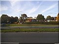
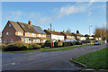
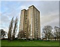
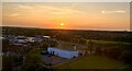
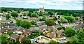
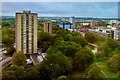
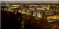
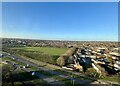
Photos of Stevenage

Area Information
Living in Stevenage means settling into a built-up area defined by clear boundaries and a distinct rhythm of daily life. The town covers an area of 21.9 square kilometres, creating a compact environment where neighbours are often neighbours. With a total population of 46,577, the community retains a manageable scale while offering the infrastructure of a significant urban centre. This density results in an average population density of 2,132 people per square kilometre, ensuring that public transport and local services remain within easy reach without the overcrowding found in larger metropolitan hubs. Residents experience a strong sense of locality within these limits. The geography supports a lifestyle where work, leisure, and home are frequently interconnected due to the town's concentrated nature. Families settle here knowing the estate is substantial enough for varied amenities yet intimate enough for familiar weekly visits. The character of the area reflects a settled population that has adopted the town as their permanent home. For those considering homes in Stevenage, the compact footprint guarantees that the majority of daily needs are local, removing the necessity for frequent long-distance commuting. You will find a diverse array of housing options scattered across the 21.9 km² landscape. The town balances residential needs with commercial activity, providing a self-contained environment for living. This setting appeals to buyers who prioritise convenience and community proximity over the anonymity of a sprawling city. The stability of the population and the defined borders create a predictable living experience. Whether you seek privacy or community, the structure of Stevenage supports both through its organised layout and established neighbourhoods.
- Area Type
- District/Borough
- Area Size
- 21.9 km²
- Population
- 46577
- Population Density
- 2132 people/km²
Demographics
The community within Stevenage is defined by a notably mature demographic profile. The median age stands at 70 years, indicating that the town is home to a significantly older population than the national average. This age statistic shapes the social fabric and the type of housing demand found in the area. A majority of age groups contribute to this aggregate, but the high median suggests a retirement town. Consequently, the demand for homes in Stevenage often leans towards properties accessible to older residents, such as single-storey bungalows or detached houses with gardens. Home ownership drives the social structure, with 61% of residents owning their properties outright or with a mortgage. This high rate of ownership creates a stable, long-term community with low tenant turnover. The remaining 39% live in rented accommodation, which introduces some flexibility to the housing stock but keeps the core population settled. The data does not specify household composition breakdowns, but the high ownership rate strongly suggests that many two-adult households exist alongside single-person households common in retirement communities. You will encounter a settled population where residents have deep roots. This stability influences local governance and community events. The lack of recent migration data underscores a static demographic, meaning that new residents must integrate into an existing, established way of life. This environment offers quiet neighbourhoods without the rapid flux of transient populations. For buyers, this means purchasing into a known community rather than incubating a new one, bringing certainty to your investment and lifestyle plans.