Area Overview for North Hertfordshire District
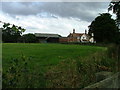
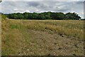
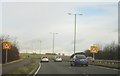
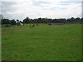
Photos of North Hertfordshire District
Area Information
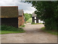
North Hertfordshire District covers an extensive 375.5-square-kilometre area within eastern England. As a local authority district, it serves as the administrative headquarters for a region containing the distinct towns of Hitchin, Letchworth Garden City, Baldock, and Royston. You will find this area lies on a northeasterly extension of the chalky Chiltern Hills plateau, situated approximately 40 miles north of central London. The district was established as a unified local government authority on 1 April 1974 under the Local Government Act 1972. It incorporated several former urban and rural districts, including those formerly known as Hitchin and Royston Urban Districts. Living in North Hertfordshire District means balancing market town life with over 30 picturesque villages and accessible open countryside. The landscape includes parts of the Chiltern Hills Area of Outstanding Natural Beauty and rare chalk streams. You can explore notable features like Knebworth House, which offers a dinosaur trail and a large maze, or visit the Therfield Heath Site of Special Scientific Interest famed for rare Pasque flowers. Historic sites such as St Paul's Walden Bury, the childhood home of Queen Elizabeth The Queen Mother, sit alongside modern museum facilities like the British Schools Museum in Hitchin. The local economy supports a mix of light industries, ranging from machinery production in Letchworth to agriculture in the rural communities.
- Area Type
- District/Borough
- Area Size
- 375.5 km²
- Population
- Not available
- Population Density
- Not available
Demographics
The community profile of North Hertfordshire District shows a notably older population compared to the national average. The median age in the district stands at 70 years. Age range data indicates the total population skews significantly older, reflecting the historical development of towns like Letchworth. Home ownership remains a dominant feature of the residential landscape. Approximately 66% of the area is owner-occupied. This high figure suggests a community where long-term residents have settled into their properties rather than living in short-term rentals. Household composition data reflects the broader demographic trends across the total population. The area does not display a predominance of young families or single-person households typical of city centres. Instead, the housing stock supports a population structure where shared homes or larger families might be less common than in other regions. The ethnic make-up and religious affiliation data cover the total population without highlighting specific majorities that differ from national norms. This stability in ownership and age suggests a quiet, established neighbourhood where residents often stay for decades. You are likely to encounter neighbours who have lived in the same streets for generations, valuing the connection to their locality and the surrounding villages.
Household Size
Accommodation Type
Tenure
Ethnic Group
Religion
Household Composition
Age
Household Deprivation
NS-SEC
Explore more demographic insights in this area
Go to Demographics tabPlanning
Planning Constraints
- Flood RiskPremium
- Ramsar Wetland SitesPremium
- Area of Outstanding Natural BeautyPremium
- Protected Nature ReservePremium
- Protected WoodlandPremium
- Crime RiskPremium