Area Overview for Blackmore End (North Hertfordshire)
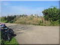
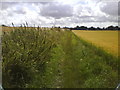
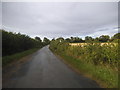
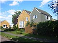
Photos of Blackmore End (North Hertfordshire)


Area Information
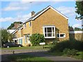
Living in Blackmore End (North Hertfordshire) offers a blend of suburban tranquillity and practical connectivity. Situated within North Hertfordshire, this built-up area spans 59 hectares and is characterised by its mature population, with a median age of 70. The community is predominantly owner-occupied, with 81% of homes in private hands, suggesting a stable, long-term resident base. Daily life here is shaped by proximity to key infrastructure: three railway stations, including Harpenden and Welwyn North, provide access to London and surrounding towns, while London Luton Airport is within reach. The area’s low crime risk—scoring 92 out of 100—adds to its appeal for families and retirees seeking safety. Though compact, Blackmore End benefits from nearby retail hubs like Tesco Harpenden and Budgens Kimpton, ensuring everyday needs are met. Its location balances accessibility with a sense of quiet, making it suitable for those prioritising security, convenience, and a slower pace of life.
- Area Type
- Built Up Area 250
- Area Size
- 59.0 hectares
- Population
- Not available
- Population Density
- Not available
Residents of Blackmore End (North Hertfordshire) have access to essential amenities within practical reach. Retail options include Tesco Harpenden, Tesco Wheathampstead, and Budgens Kimpton, ensuring grocery and daily shopping needs are met. The area’s rail network, with stations like Harpenden and Welwyn North, connects to London and surrounding towns, while London Luton Airport provides regional and international travel options. Though specific parks or leisure facilities are not detailed, the presence of multiple retail and transport hubs suggests a lifestyle focused on convenience. The character of the area is defined by its practicality, with amenities designed for ease of access rather than luxury. This makes it ideal for those prioritising reliability over novelty, with everyday needs met by nearby services and efficient transport links.
Amenities
Schools
| Rank | A + A* % | School | Type | Entry gender | Ages |
|---|
Explore more schools in this area
Go to Schools tabDemographics
Blackmore End (North Hertfordshire) has a median age of 70, indicating a population skewed toward older adults. The home ownership rate of 81% suggests a community of long-term residents, with few rental properties. The data does not specify household composition or diversity, but the high home ownership figure implies a stable, settled demographic. The area’s accommodation types are not detailed, but the overall profile points to a mature, low-mobility population. While no deprivation data is provided, the high home ownership and low crime risk suggest a quality of life that prioritises security and permanence. This aligns with the presence of nearby amenities, which cater to established residents rather than transient populations. The area’s character is defined by its older demographic, with services and infrastructure tailored to their needs.
Household Size
Accommodation Type
Tenure
Ethnic Group
Religion
Household Composition
Age
Household Deprivation
NS-SEC
Explore more demographic insights in this area
Go to Demographics tabPlanning
Planning Constraints
- Crime RiskLocked