Area Overview for Aldenham
Photos of Aldenham

Area Information
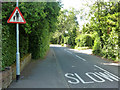
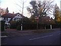
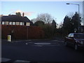
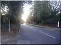
Aldenham is a civil parish located in the borough of Hertsmere within Hertfordshire. You will find the parish three and a half miles north-east of Watford and two miles south-west of Radlett. This area covers 23.9 square kilometres and contains a population of 3,236 residents. The settlement is not merely a single village but encompasses three main areas: Aldenham village, Radlett, and Letchmore Heath. As one of Hertsmere's 14 conservation areas, the parish maintains a historic character dating back to Saxon times. Eight pre-19th-century buildings hold listed status, guarding a landscape that has remained largely unchanged for centuries. The proximity to Elstree Studios makes the location well known for its frequent use in film productions and television series. Living in Aldenham means residing in a region where history and modern convenience intersect. The parish sits 12 miles from Marble Arch as the crow flies, providing a defined geographical boundary for this historic community. You inhabit a space where the past is physically embedded in the architecture and planning of the present.
- Area Type
- Parish
- Area Size
- 23.9 km²
- Population
- 3236
- Population Density
- 136 people/km²
Demographics
The community profile of Aldenham reveals a distinct demographic shape driven by its established nature. The median age for residents is 70 years, indicating an older population compared to many urban centres. This age distribution suggests a neighbourhood where long-term residents form the backbone of local life. Home ownership stands at 86% of households, meaning the vast majority of people living in Aldenham reside in properties they own outright or have significant equity. Such high ownership rates typically correlate with roots in the area and stability within the local community. The data indicates that the total household composition and total accommodation types span the specific needs of this demographic base. While specific breakdowns of household types, predominant ethnic groups, and religious affiliations are not detailed in the current records, the overall picture points toward a settled population. An age profile centred on retirement or older adulthood often influences local service demand and community engagement patterns. You are joining an area where residents have likely established deep ties to the parish over many decades. The environment supports a lifestyle that caters to those who have chosen to make their home in this specific corner of Hertfordshire.
Household Size
Accommodation Type
Tenure
Ethnic Group
Religion
Household Composition
Age
Household Deprivation
NS-SEC
Explore more demographic insights in this area
Go to Demographics tabPlanning
Planning Constraints
- Flood RiskPremium
- Ramsar Wetland SitesPremium
- Area of Outstanding Natural BeautyPremium
- Protected Nature ReservePremium
- Protected WoodlandPremium