Area Overview for Hertsmere District (B)
Photos of Hertsmere District (B)
Area Information
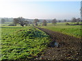
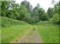
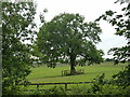
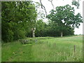
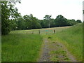
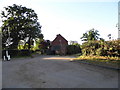
Living in Hertsmere District (B) offers a landscape defined by stability and established character. This local authority district spans 101.2 km², providing a suburban environment that has evolved over decades rather than being shaped by rapid, recent development. The area is defined less by its transient nature and more by its long-term residents who have chosen to settle down. Daily life here moves at a deliberate pace, characteristic of a community where generations often remain within the same geographical bounds. You will find that the rhythm of the district is set by local routines rather than the constant churn typical of younger urban zones. The sheer size of the district ensures a mix of residential settings, though the overall impression is one of quiet consistency. Prospective buyers must appreciate that this district operates with a distinct identity separate from the faster-growing boroughs nearby. The 101.2 km² footprint means that amenities are spread out, requiring careful consideration of where you specifically locate your home. There is no sudden urban density or industrial sprawl disrupting the residential fabric. Instead, the area presents a canvas where established neighbourhoods dominate. If you are looking for a home in Hertsmere District (B), you are entering a space where the existing infrastructure and community structures are mature. The district reflects a choice for stability over adventure, mirroring the needs of families seeking a settled environment. Your daily commute and leisure activities will be dictated by this fixed, predictable geography. Understanding this layout is essential before you visit any specific street or consider your long-term plans within the borders of Hertsmere District (B).
- Area Type
- District/Borough
- Area Size
- 101.2 km²
- Population
- Not available
- Population Density
- Not available
Demographics
The community within Hertsmere District (B) is defined by a significant demographic shift towards older populations. Data indicates a median age of 70 years, which contrasts sharply with national averages for working-age areas. This implies that the majority of the population falls into retirement age brackets, creating a neighbourhood atmosphere focused on quiet living and established social circles. When you consider living in Hertsmere District (B), you are entering an area where the typical resident has likely worked through their career and now prioritises leisure and community connection. This age profile directly influences local services, from healthcare access to community activities designed for seniors. Home ownership levels in the district stand at 65%, a figure that underscores the stability of the local population. Nearly two-thirds of households own their property, suggesting low turnover rates and deep roots in the area. This high ownership rate aligns with the older median age, as homeowners often accumulate wealth and buy retirement properties in later life. The household composition and predominant ethnic group data highlight the homogeneity of the community, though specific breakdowns are not detailed in the current records. You can expect a environment where neighbours have known each other for decades. The medium crime risk, scoring 66 out of 100, places the district alongside average national standards, meaning standard security precautions remain advisable rather than reflecting a high-threat environment. Overall, the demographic picture points to a settled, owner-occupied community with an ageing profile, making it a specific choice for those seeking retirement housing or families settling down permanently.
Household Size
Accommodation Type
Tenure
Ethnic Group
Religion
Household Composition
Age
Household Deprivation
NS-SEC
Explore more demographic insights in this area
Go to Demographics tabPlanning
Planning Constraints
- Flood RiskPremium
- Ramsar Wetland SitesPremium
- Area of Outstanding Natural BeautyPremium
- Protected Nature ReservePremium
- Protected WoodlandPremium