Area Overview for Kings Langley
Photos of Kings Langley


Area Information
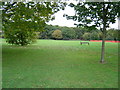
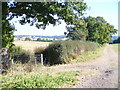
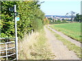
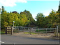
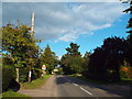
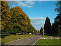
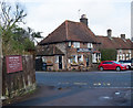
Kings Langley is a compact district borough unitary ward located in England, covering just 8.3 km². This relatively small area has evolved into a distinct residential community with a specific demographic profile. Living in Kings Langley offers a settled environment where daily life revolves around a high rate of home ownership. The area attracts older residents, reflecting a quiet and established neighbourhood character. You will find that the majority of people in Kings Langley own their homes, creating a stable local community. There is no evidence of industrial development or heavy commercial zones within this ward; the focus remains strictly residential. The size of the area means that distances between homes and amenities are short, allowing for pedestrian-friendly daily routines. Prospective buyers often look at Kings Langley for its combination of rural feel and relatively modern connectivity. The ward does not contain major planning constraints like extensive wetlands or protected nature reserves, aside from a small amount of protected woodland. This spatial efficiency and ownership stability define the living experience here. When you consider homes in Kings Langley, you are choosing a smaller, tightly defined community rather than a sprawling suburb.
- Area Type
- Parish
- Area Size
- 8.3 km²
- Population
- Not available
- Population Density
- Not available
Demographics
The community in Kings Langley is defined by a significantly older population. The median age stands at 70 years, marking this as an area populated primarily by older adults. This demographic reality shapes the pace of life and the local services required. The most common age range represents the total age bracket, further emphasising that the population leans heavily towards retirement years. Home ownership is exceptionally high at 75%, indicating that three out of four households own their properties outright or with a significant portion of the value paid off. This high level of equity suggests a generation that has spent years establishing roots in the village. Household composition and accommodation type data reflect a total count that aligns with this older, owner-occupied demographic. Ethnic diversity, religious makeup, and specific deprivation metrics are not highlighted in the current profile of Kings Langley. The absence of young families or transient populations creates a very consistent social fabric. If you are looking to buy, you enter a market where long-term residents dominate the neighbourhood. The lack of data on specific ethnic or religious breakdowns means the community feels homogeneous in its census reporting. For those considering living in Kings Langley, prepare for an environment where social interactions are driven by established, home-owning neighbours rather than new developments attracting younger tenants.
Household Size
Accommodation Type
Tenure
Ethnic Group
Religion
Household Composition
Age
Household Deprivation
NS-SEC
Explore more demographic insights in this area
Go to Demographics tabPlanning
Planning Constraints
- Flood RiskPremium
- Ramsar Wetland SitesPremium
- Area of Outstanding Natural BeautyPremium
- Protected Nature ReservePremium
- Protected WoodlandPremium