Area Overview for Dacorum District (B)
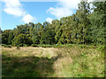
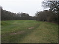
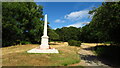
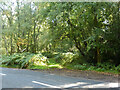
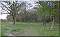
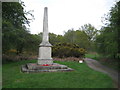
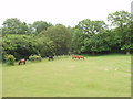
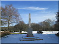
Photos of Dacorum District (B)


Area Information
Living in Dacorum District (B) means residing within a local authority district that spans 212.6 square kilometres across England. This substantial geographic area provides residents with significant open space and distinct local character. The community is defined by its older demographic, which forms the core of daily social life here. You will find that the area is not primarily a destination for young families or students, but rather a settled environment. The district functions as a self-contained zone where the rhythm of life moves relatively slowly compared to major urban centres. Prospective buyers looking for Dacorum District (B) should understand that this is a mature district with established routines. The sheer size of the district allows for a variety of internal neighbourhoods, each with its own specific feel. However, the demographic reality shapes the cultural landscape significantly. When you visit the locality, you encounter a stable population rather than a transient one. This consistency offers a long-term sense of security for those considering a move into Dacorum District (B). ### The community profile of Dacorum District (B) is heavily weighted toward older residents. The median age across the district is 70 years, indicating a predominantly senior population. This age structure suggests that the area serves as a retirement haven or a place where residents stay well into later life. You will notice that the most common age range covers the total population, reinforcing the lack of a significant youth demographic. Home ownership stands at 65%, which is a relatively high figure. This statistic confirms that the majority of people in Dacorum District (B) own their residences outright or with a mortgage, rather than renting. The high ownership rate typically correlates with the older median age, as homeowners tend to retire in situ. Accommodation types and household composition data support this picture of a settled, established community. You will find larger family homes or bungalows predominating over starter properties. The diversity of the ethnic makeup and religious affiliations presents specific challenges for understanding the local cultural fabric without more granular breaks down of those specific categories. ### The housing market in Dacorum District (B) is characterised by a strong bias toward owner-occupiers. With home ownership levels reaching 65%, the area reflects an established stock rather than a dynamic rental economy. This balance means that if you are looking to buy homes in Dacorum District (B), you will likely compete with other buyers rather than facing a landlord-heavy environment. The accommodation type data indicates a settled pattern of occupancy. You will find that properties here are often passed down through generations or purchased for long-term residence. This stability can lead to slower market turnover compared to high-growth rental zones. The housing stock is therefore likely composed of structures suited to the median age of 70. Buyers should expect a market where demand from downsizers or those seeking permanent retirement homes drives prices. The 65% ownership figure remains the single most defining metric of this local property landscape. It tells you that renting assets are far less common than owned assets within the district boundaries. ### Connectivity within Dacorum District (B) presents a mixed picture for modern digital lifestyles. Mobile coverage scores an 82 out of 100, rating as good for daily commuting or making calls while outside. This level of performance supports standard communication needs for residents who travel frequently. Conversely, fixed broadband quality presents a significant constraint with a score of 28 out of 100. This rating qualifies as poor and will severely impact any attempt to work from home regularly. You cannot rely on a stable high-speed connection for video conferencing or large file transfers using current fixed line infrastructure. For professionals requiring robust internet connectivity, this limitation may outweigh the benefits of relocating here. The disparity between mobile and fixed scores is stark. While you may stay connected on your phone, your home office setup will struggle without upgrades. If you consider Dacorum District (B) for remote work, you must factor in the cost and feasibility of installing superior private fibre or business-grade connections to compensate for the weak public fixed broadband network. ### Safety and environmental conditions in Dacorum District (B) show distinct positives and notable planning constraints. Crime risk registers a pass level with a score of 69 out of 100. This indicates below-average crime rates and a safer neighbourhood environment for occupants. You can feel confident that general security risks are low compared to many other districts. Flooding poses little threat with a pass status and a low risk score of 4.05. The area also contains no Ramsar wetland sites, removing specific protected weak points from the planning equation. However, nature protection introduces genuine planning complexities. An Area of Outstanding Natural Beauty designation registers as a warning with a score of 42.61. Protected nature reserves, woods, and other green spaces operate under this warning level with scores of 2.15 and 4.53 respectively. These designations restrict development potential in specific zones. While the crime and flood data offer reassurance, the presence of protected environments you must navigate if planning future property purchases or extensions. ### What is the community feel like in Dacorum District (B)? The community feels distinctly established with a mature demographic profile. The median age sits at 70, creating a neighbourhood dominated by an older population rather than young families. This stability is reflected in high home ownership levels of 65%. You are not looking at a rapidly changing area but a settled district where residents have long-term roots. The 212.6 square kilometre size allows this demographic to define the cultural rhythm without significant interruption from younger transients. Can I work from home reliably here? You should proceed with caution if remote work is your primary need. Your fixed broadband connection is rated as poor, scoring only 28 out of 100. This score is insufficient for professional video calls or heavy data usage. While mobile coverage is good at 82 out of 100, relying on mobile data for work is not practical. You would need to invest heavily in private connectivity solutions to bridge this gap. Is the area safe and environmentally secure? The area scores well on safety metrics. Crime risk is low with a score of 69 out of 100, indicating a safer neighbourhood. Flooding is not a concern with a risk score of 4.05. However, you must respect significant planning constraints. The district contains protected woodlands and nature reserves under warning status. These natural features limit building development potential, ensuring you maintain the area's green characteristics.
- Area Type
- District/Borough
- Area Size
- 212.6 km²
- Population
- Not available
- Population Density
- Not available
Demographics
The community profile of Dacorum District (B) is heavily weighted toward older residents. The median age across the district is 70 years, indicating a predominantly senior population. This age structure suggests that the area serves as a retirement haven or a place where residents stay well into later life. You will notice that the most common age range covers the total population, reinforcing the lack of a significant youth demographic. Home ownership stands at 65%, which is a relatively high figure. This statistic confirms that the majority of people in Dacorum District (B) own their residences outright or with a mortgage, rather than renting. The high ownership rate typically correlates with the older median age, as homeowners tend to retire in situ. Accommodation types and household composition data support this picture of a settled, established community. You will find larger family homes or bungalows predominating over starter properties. The diversity of the ethnic makeup and religious affiliations presents specific challenges for understanding the local cultural fabric without more granular breaks down of those specific categories. ### The housing market in Dacorum District (B) is characterised by a strong bias toward owner-occupiers. With home ownership levels reaching 65%, the area reflects an established stock rather than a dynamic rental economy. This balance means that if you are looking to buy homes in Dacorum District (B), you will likely compete with other buyers rather than facing a landlord-heavy environment. The accommodation type data indicates a settled pattern of occupancy. You will find that properties here are often passed down through generations or purchased for long-term residence. This stability can lead to slower market turnover compared to high-growth rental zones. The housing stock is therefore likely composed of structures suited to the median age of 70. Buyers should expect a market where demand from downsizers or those seeking permanent retirement homes drives prices. The 65% ownership figure remains the single most defining metric of this local property landscape. It tells you that renting assets are far less common than owned assets within the district boundaries. ### Connectivity within Dacorum District (B) presents a mixed picture for modern digital lifestyles. Mobile coverage scores an 82 out of 100, rating as good for daily commuting or making calls while outside. This level of performance supports standard communication needs for residents who travel frequently. Conversely, fixed broadband quality presents a significant constraint with a score of 28 out of 100. This rating qualifies as poor and will severely impact any attempt to work from home regularly. You cannot rely on a stable high-speed connection for video conferencing or large file transfers using current fixed line infrastructure. For professionals requiring robust internet connectivity, this limitation may outweigh the benefits of relocating here. The disparity between mobile and fixed scores is stark. While you may stay connected on your phone, your home office setup will struggle without upgrades. If you consider Dacorum District (B) for remote work, you must factor in the cost and feasibility of installing superior private fibre or business-grade connections to compensate for the weak public fixed broadband network. ### Safety and environmental conditions in Dacorum District (B) show distinct positives and notable planning constraints. Crime risk registers a pass level with a score of 69 out of 100. This indicates below-average crime rates and a safer neighbourhood environment for occupants. You can feel confident that general security risks are low compared to many other districts. Flooding poses little threat with a pass status and a low risk score of 4.05. The area also contains no Ramsar wetland sites, removing specific protected weak points from the planning equation. However, nature protection introduces genuine planning complexities. An Area of Outstanding Natural Beauty designation registers as a warning with a score of 42.61. Protected nature reserves, woods, and other green spaces operate under this warning level with scores of 2.15 and 4.53 respectively. These designations restrict development potential in specific zones. While the crime and flood data offer reassurance, the presence of protected environments you must navigate if planning future property purchases or extensions. ### What is the community feel like in Dacorum District (B)? The community feels distinctly established with a mature demographic profile. The median age sits at 70, creating a neighbourhood dominated by an older population rather than young families. This stability is reflected in high home ownership levels of 65%. You are not looking at a rapidly changing area but a settled district where residents have long-term roots. The 212.6 square kilometre size allows this demographic to define the cultural rhythm without significant interruption from younger transients. Can I work from home reliably here? You should proceed with caution if remote work is your primary need. Your fixed broadband connection is rated as poor, scoring only 28 out of 100. This score is insufficient for professional video calls or heavy data usage. While mobile coverage is good at 82 out of 100, relying on mobile data for work is not practical. You would need to invest heavily in private connectivity solutions to bridge this gap. Is the area safe and environmentally secure? The area scores well on safety metrics. Crime risk is low with a score of 69 out of 100, indicating a safer neighbourhood. Flooding is not a concern with a risk score of 4.05. However, you must respect significant planning constraints. The district contains protected woodlands and nature reserves under warning status. These natural features limit building development potential, ensuring you maintain the area's green characteristics.
Household Size
Accommodation Type
Tenure
Ethnic Group
Religion
Household Composition
Age
Household Deprivation
NS-SEC
Explore more demographic insights in this area
Go to Demographics tabPlanning
Planning Constraints
- Flood RiskPremium
- Ramsar Wetland SitesPremium
- Area of Outstanding Natural BeautyPremium
- Protected Nature ReservePremium
- Protected WoodlandPremium