Area Overview for Frinton and Walton
Photos of Frinton and Walton


Area Information
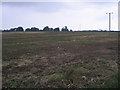
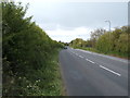
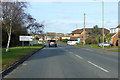
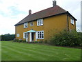
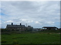
Frinton and Walton occupies a unique position on the Essex coast as a planned, exclusive seaside resort. The area covers 27.9 km² and supports a population of 14,887 residents. Its history dates back to 1086, recorded as Frientuna in the Domesday Book, but it transformed into a modern holiday destination after the Frinton railway station opened in 1888. Developers such as Peter Bruff and Richard Powell Cooper established strict building controls early on, creating the quiet, upscale atmosphere you experience today. This zone merged in 1934 and remains distinct from busier neighbours like Clacton by resisting heavy commercialisation. You walk wide unspoilt greensward seafronts and historic streets like Connaught Avenue, which opened in 1904. The character here is select and controlled, offering a pace of life that contrasts sharply with typical coastal towns. St Mary's Church anchors the community, with portions dating to the 14th century. Whether exploring the Frinton Park Estate with its Modern Movement architecture or visiting the former lido site, the landscape feels curated rather than chaotic. Living in Frinton and Walton means enjoying a setting defined by historical purpose rather than opportunistic growth.
- Area Type
- Parish
- Area Size
- 27.9 km²
- Population
- 14887
- Population Density
- 534 people/km²
Demographics
The community profile reflects a distinctly mature demographic, with a median age of 70 years. This high median age suggests a neighbourhood dominated by retirees and older family members rather than young professionals or students. Households vary in composition, though the specific breakdown is not detailed in the current records. Home ownership stands at 81%, indicating that the vast majority of residents own their properties outright or have significant equity. This high rate aligns with the area's history as a resort built for self-contained living rather than temporary lodging. You are likely to find long-term residents who have stayed since the post-war era or moved here later in life. The accommodation stock and predominant ethnic group data indicate a fairly standard local makeup without specific skew mentioned in the provided figures. Religion statistics are not specified, leaving the spiritual landscape open for personal interpretation. With 14,887 people spread across this sizeable plot, density remains manageable at 534 people per km². Living here offers stability for those seeking a retirement haven where community ties often span generations. The quiet nature suits those who value faces that have been known for decades.
Household Size
Accommodation Type
Tenure
Ethnic Group
Religion
Household Composition
Age
Household Deprivation
NS-SEC
Explore more demographic insights in this area
Go to Demographics tabPlanning
Planning Constraints
- Flood RiskPremium
- Ramsar Wetland SitesPremium
- Area of Outstanding Natural BeautyPremium
- Protected WoodlandPremium