Area Overview for Halstead
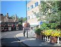
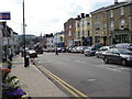
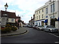
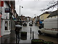
Photos of Halstead
Area Information
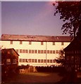
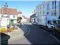
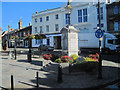
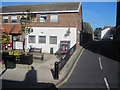
Halstead Rural stands as a distinct civil parish within the Braintree District of Essex, covering an area of 5.3 km². Created in 1894, this parish encompasses the rural hinterlands to the north, west, and south of the historic town of Halstead. The boundary lines were redrawn at that time, separating the newer Halstead Rural from the halstead Urban area, which later gained full town status. You are living in a location with deep historical roots, first recorded in the Domesday Book of 1086 alongside three water mills. The parish includes local hamlets such as Greenstead Green, a place transferred to the urban district in 1934 before being renamed in 1974. The daily rhythm here centres around a small population of 1,780 people. This figure reflects a tight-knit community rather than a sprawling settlement. The location lies near the River Colne, maintaining a connection to the landscape that defined the original Hinckford Hundred. When you consider living in Halstead Rural, you enter a space that balances its ancient heritage with modern administrative boundaries. The area was officially split from the main town more than a century ago, yet it remains functionally linked to the services of the nearby urban centre. Your perspective from here looks out over fields and settlements that have existed for centuries, offering a sense of continuity that defines life in this southern Essex parish.
- Area Type
- County Electoral Division
- Area Size
- 5.3 km²
- Population
- 1780
- Population Density
- 334 people/km²
Demographics
The community character of Halstead Rural is defined by an older population profile. The median age for residents is 70 years old, indicating that the area is predominantly inhabited by seniors. Most homes are occupied by older households rather than young families or single workers. This demographic structure explains the higher prevalence of older age ranges across the parish compared to national averages. With 67% of residents owning their homes, the neighbourhood reflects a settled, long-term population rather than a transient rental market. Home ownership levels show that two-thirds of households manage their own properties. This statistic suggests that buying into this area often means inheriting a family connection or securing a permanent base. The low proportion of renters supports the view that Halstead Rural functions as a retirement destination or a semi-retirement hub for those who can afford their own equity. You are purchasing a lifestyle where stability is the norm. The household composition data confirms that traditional, multi-generational living patterns have anchored this village. When you explore living in Halstead, you enter a community where neighbours have likely known one another for decades, and the social fabric relies on established connections rather than transient networks.
Household Size
Accommodation Type
Tenure
Ethnic Group
Religion
Household Composition
Age
Household Deprivation
NS-SEC
Explore more demographic insights in this area
Go to Demographics tabPlanning
Planning Constraints
- Flood RiskPremium
- Ramsar Wetland SitesPremium
- Area of Outstanding Natural BeautyPremium
- Protected Nature ReservePremium
- Protected WoodlandPremium