Area Overview for Fairstead
Photos of Fairstead
Area Information
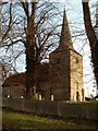
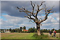
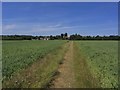
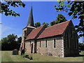
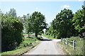
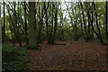
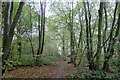
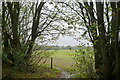
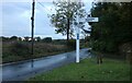
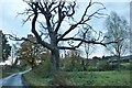
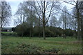
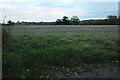
Fairstead is a small rural village situated within the Braintree district of Essex, covering a total area of 8.0 km². The village functions as an isolated community of farming hamlets, encompassing the settlements of Fuller Street and Rank's Green. Its name originates from Old English, likely meaning 'place where a fair was held'. Historically mentioned in the Domesday Book of 1086 with 17 households, the population has remained relatively stable for centuries. In 1801, there were 260 residents, which grew to around 290 by the 2011 census before peaking at 350 in 1831. Today, the village offers a quiet, secluded lifestyle defined by its connection to agriculture and its location on the Essex Way, an 81-mile waymarked long-distance footpath. You will find houses in Fairstead are primarily occupied by individuals seeking a tranquil environment away from urban congestion. The village sits approximately 9.8 miles from Chelmsford, the county town of Essex. While the place is isolated, it maintains close connections to nearby locations such as Great Leighs, White Notley, and Witham. The local character is shaped by the Square and Compasses pub, a historic building dating back to 1652. Those considering living in Fairstead should expect a village defined by farming hamlets rather than dense urban development. The area provides a distinct break from city life, appealing to those who prioritise quiet over proximity to major transport hubs.
- Area Type
- Parish
- Area Size
- 8.0 km²
- Population
- Not available
- Population Density
- Not available
Demographics
The community in Fairstead is characterised by a significantly older population compared to the national average. The median age for residents is 70 years old, indicating a settled demographic with families or younger residents relatively few in number. This age profile suggests that the area hosts退休 residents or individuals in long-term rural establishments rather than a dynamic mix of young families. Home ownership is the dominant tenure type within the village, with 63% of homes owned outright or with a mortgage. This high rate of ownership contrasts sharply with areas dominated by private renting. Regarding household composition and accommodation types, the specific breakdowns are not currently detailed in the available records. Nevertheless, the predominance of owner-occupiers points towards stable, long-term households rather than transient populations. The population count shows 158 males and 132 females within the 290 residents recorded in 2011. This gender balance reflects a typical rural setting. Professional roles have become more common among the working population. While agriculture employed only 6.4% of residents in 2011, 21.2% worked in management or senior professional positions. The ethnic background and religious composition also lack specific current figures, but the historical context of the village remains rooted in its long-standing identity as a parish in the Braintree district.
Household Size
Accommodation Type
Tenure
Ethnic Group
Religion
Household Composition
Age
Household Deprivation
NS-SEC
Explore more demographic insights in this area
Go to Demographics tabPlanning
Planning Constraints
- Flood RiskPremium
- Ramsar Wetland SitesPremium
- Area of Outstanding Natural BeautyPremium
- Protected Nature ReservePremium
- Protected WoodlandPremium