Area Overview for Braintree
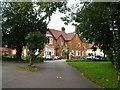
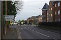
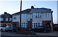
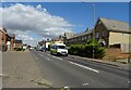
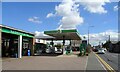
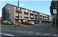
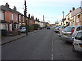
Photos of Braintree
Area Information
Braintree is a compact built-up area in England, spanning 10.2 km² and home to 8,158 residents. With a population density of 803 people per square kilometre, it is a tightly knit community where daily life is shaped by proximity to essential services. The area’s character is defined by its balance of residential and commercial spaces, with amenities within practical reach. While the median age of 70 suggests a predominantly older population, the mix of home ownership and rental properties indicates a diverse housing landscape. Braintree’s strategic location offers easy access to nearby towns via rail and bus networks, making it a practical choice for commuters. The presence of multiple primary schools, retail outlets, and transport hubs underscores its appeal as a self-contained community, though its smaller size means residents often rely on surrounding areas for broader services. For those seeking a quiet, established area with well-established infrastructure, Braintree offers a blend of convenience and tradition.
- Area Type
- Built Up Area 250
- Area Size
- 10.2 km²
- Population
- 8158
- Population Density
- 803 people/km²
Braintree’s lifestyle is shaped by its proximity to essential amenities. The area includes five retail outlets, such as Sainsburys Braintree and Tesco Braintree, providing convenience for shopping and daily needs. Rail stations like Braintree Railway Station and Cressing Railway Station offer easy access to nearby towns and cities, while the bus interchange connects residents to broader networks. The presence of multiple primary schools and nurseries reinforces the area’s family-friendly appeal. Though parks and leisure facilities are not explicitly listed in the data, the compact layout suggests a community-focused environment where local services and social hubs are within walking distance. The combination of retail, transport, and education options creates a self-contained lifestyle, ideal for those prioritising accessibility and practicality over expansive green spaces.
Amenities
Schools
Braintree is served by several primary schools, including Beckers Green Primary School, Bocking Church Street Primary School, Chapel Hill Primary School and Nursery, John Ray Infant School, and John Bunyan Primary School and Nursery, which holds an Ofsted rating of ‘good’. These institutions cater to young families, providing a range of educational options within the area. The presence of multiple primary schools ensures accessibility for local children, though no secondary schools are listed in the data. The mix of primary schools, including nurseries, suggests a focus on early education and family-friendly infrastructure. For parents prioritising school proximity, Braintree’s schools are a key consideration, though the absence of secondary options may require families to look beyond the immediate area for comprehensive education. The ‘good’ rating at John Bunyan Primary School indicates at least one institution meeting high standards of teaching and facilities.
| Rank | A + A* % | School | Type | Entry gender | Ages |
|---|---|---|---|---|---|
| 1 | N/A | Beckers Green Primary School | primary | N/A | N/A |
| 2 | N/A | Bocking Church Street Primary School | primary | N/A | N/A |
| 3 | N/A | Chapel Hill Primary School and Nursery | primary | N/A | N/A |
| 4 | N/A | John Bunyan Primary School and Nursery | primary | N/A | N/A |
| 5 | N/A | John Ray Infant School | primary | N/A | N/A |
Explore more schools in this area
Go to Schools tabDemographics
Braintree’s population has a median age of 70, the highest recorded figure in the data, indicating a community skewed toward older residents. Home ownership stands at 66%, suggesting a stable housing market where many residents have long-term ties to the area. The accommodation types and household compositions are listed as ‘total’, which means no specific breakdown is available, but the high home ownership rate implies a mix of family homes and single-occupancy properties. The predominant ethnic group and religion are also categorised as ‘total’, so no further details are provided on diversity. The age profile and ownership statistics suggest a mature, settled population with fewer young families, which may influence the local character and service needs. While deprivation data is not specified, the area’s amenities and transport links suggest a moderate quality of life for its residents.
Household Size
Accommodation Type
Tenure
Ethnic Group
Religion
Household Composition
Age
Household Deprivation
NS-SEC
Explore more demographic insights in this area
Go to Demographics tabPlanning
Planning Constraints
- Crime RiskLocked