Area Overview for EN8 0EE
Photos of EN8 0EE
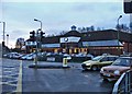
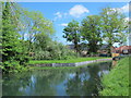
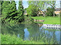
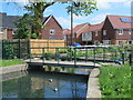
34 photos from this area
Area Information
Key information about the EN8 0EE including its size, population, and administrative classification.
- Area Type
- Postcode
- Area Size
- 1.1 hectares
- Population
- 2866
- Population Density
- 1745 people/km²
House Prices in EN8 0EE
25
Properties
£350,476
Average Sold Price
£118,000
Lowest Price
£565,000
Highest Price
Showing 25 properties
| Address | Type | Beds | Baths | Last Sale Price | Last Sale Date | |
|---|---|---|---|---|---|---|
| 8 Arundel Close, Cheshunt, EN8 0EE | Semi-detached | 4 | 2 | £565,000 | Jun 2023 | |
| 28 Arundel Close, Cheshunt, EN8 0EE | Retail | 3 | 2 | £525,000 | Jul 2022 | |
| 14 Arundel Close, Cheshunt, EN8 0EE | Semi-detached | 3 | 2 | £454,999 | Oct 2019 | |
| 30 Arundel Close, Cheshunt, EN8 0EE | Semi-detached | 3 | 2 | £500,575 | Apr 2019 | |
| 26 Arundel Close, Cheshunt, EN8 0EE | Semi-detached | 2 | 1 | £412,500 | Feb 2019 | |
| 9 Arundel Close, Cheshunt, EN8 0EE | Bungalow | 2 | 1 | £390,000 | Nov 2017 | |
| 13 Arundel Close, Cheshunt, EN8 0EE | Semi-detached | 2 | 1 | £385,000 | Nov 2015 | |
| 7 Arundel Close, Cheshunt, EN8 0EE | Semi-detached | 3 | 1 | £390,000 | Apr 2015 | |
| 17 Arundel Close, Cheshunt, EN8 0EE | Bungalow | 4 | - | £490,000 | Aug 2012 | |
| 24 Arundel Close, Cheshunt, EN8 0EE | Bungalow | 2 | - | £249,995 | Jul 2011 |
Page 1 of 3
Energy Efficiency in EN8 0EE
Amenities
Schools
| Rank | School | Type | Entry gender | Ages |
|---|
Explore more schools in this area
Go to Schools tabDemographics
Household Size
Family (3-5 people)
most common
Accommodation Type
Houses
most common
Tenure
55
majority
Ethnic Group
White
most common
Religion
N/A
most common
Household Composition
N/A
most common
Age
47
median
Adults (30-64 years)
most common
Household Deprivation
N/A
with no deprivation
NS-SEC
28
in Lower managerial occupations
Explore more demographic insights in this area
Go to Demographics tabPlanning
Planning Constraints
- Flood RiskPremium
- Ramsar Wetland SitesPremium
- Area of Outstanding Natural BeautyPremium
- Protected Nature ReservePremium
- Protected WoodlandPremium