Area Overview for EN8 0EA
Photos of EN8 0EA
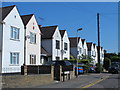
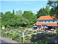
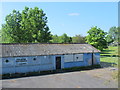
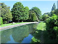
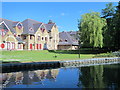
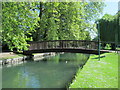
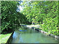
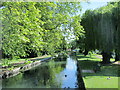
48 photos from this area
Area Information
Key information about the EN8 0EA including its size, population, and administrative classification.
- Area Type
- Postcode
- Area Size
- 1.6 hectares
- Population
- 1391
- Population Density
- 4114 people/km²
House Prices in EN8 0EA
31
Properties
£389,888
Average Sold Price
£145,995
Lowest Price
£825,000
Highest Price
Showing 31 properties
| Address | Type | Beds | Baths | Last Sale Price | Last Sale Date | |
|---|---|---|---|---|---|---|
| 128 Church Lane, Cheshunt, EN8 0EA | house | - | - | £250,000 | Oct 2023 | |
| 98 Church Lane, Cheshunt, EN8 0EA | Semi-detached | 6 | 2 | £825,000 | Aug 2023 | |
| 104 Church Lane, Cheshunt, EN8 0EA | Semi-detached | 4 | 1 | £633,000 | Jul 2023 | |
| 110 Church Lane, Cheshunt, EN8 0EA | Detached | 5 | 1 | £790,000 | Jan 2021 | |
| 122 Church Lane, Cheshunt, EN8 0EA | Terraced | 3 | 1 | £394,995 | Jul 2018 | |
| 86 Church Lane, Cheshunt, EN8 0EA | Semi-detached | 5 | - | £615,000 | Jul 2016 | |
| 116 Church Lane, Cheshunt, EN8 0EA | Terraced | 5 | - | £535,000 | Jun 2016 | |
| 124 Church Lane, Cheshunt, EN8 0EA | house | 3 | 1 | £315,000 | Jul 2015 | |
| 126 Church Lane, Cheshunt, EN8 0EA | house | 3 | - | £279,000 | Jan 2011 | |
| 92 Church Lane, Cheshunt, EN8 0EA | house | 4 | 2 | £405,000 | May 2010 |
Page 1 of 4
Energy Efficiency in EN8 0EA
Amenities
Schools
| Rank | School | Type | Entry gender | Ages |
|---|
Explore more schools in this area
Go to Schools tabDemographics
Household Size
Family (3-5 people)
most common
Accommodation Type
Houses
most common
Tenure
76
majority
Ethnic Group
White
most common
Religion
N/A
most common
Household Composition
N/A
most common
Age
47
median
Adults (30-64 years)
most common
Household Deprivation
N/A
with no deprivation
NS-SEC
28
in Lower managerial occupations
Explore more demographic insights in this area
Go to Demographics tabPlanning
Planning Constraints
- Flood RiskPremium
- Ramsar Wetland SitesPremium
- Area of Outstanding Natural BeautyPremium
- Protected Nature ReservePremium
- Protected WoodlandPremium