Area Overview for EN7 6WJ
Photos of EN7 6WJ
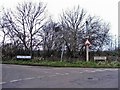
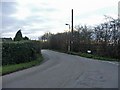
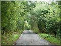
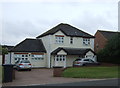
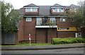
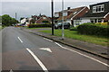
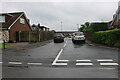
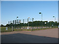
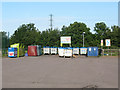
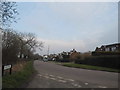
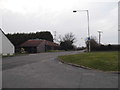
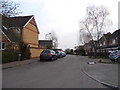
17 photos from this area
Area Information
Key information about the EN7 6WJ including its size, population, and administrative classification.
- Area Type
- Postcode
- Area Size
- 5694 m²
- Population
- 1780
- Population Density
- 2805 people/km²
House Prices in EN7 6WJ
15
Properties
£358,492
Average Sold Price
£175,000
Lowest Price
£695,000
Highest Price
Showing 15 properties
| Address | Type | Beds | Baths | Last Sale Price | Last Sale Date | |
|---|---|---|---|---|---|---|
| 18 Bloomfield Road, Cheshunt, EN7 6WJ | Detached | 4 | 3 | £645,000 | Apr 2024 | |
| 14 Bloomfield Road, Cheshunt, EN7 6WJ | Detached | 5 | 3 | £695,000 | Oct 2023 | |
| 8 Bloomfield Road, Cheshunt, EN7 6WJ | house | - | - | £582,132 | Mar 2021 | |
| 6 Bloomfield Road, Cheshunt, EN7 6WJ | Detached | 4 | 2 | £465,000 | Sep 2016 | |
| 2 Bloomfield Road, Cheshunt, EN7 6WJ | house | - | - | £455,000 | Jun 2016 | |
| 4 Bloomfield Road, Cheshunt, EN7 6WJ | Detached | 4 | 2 | £379,995 | Jul 2008 | |
| 26 Bloomfield Road, Cheshunt, EN7 6WJ | house | - | - | £375,500 | Feb 2007 | |
| 24 Bloomfield Road, Cheshunt, EN7 6WJ | Detached | - | - | £371,000 | Dec 2006 | |
| 28 Bloomfield Road, Cheshunt, EN7 6WJ | Detached | - | - | £250,000 | Aug 2001 | |
| 30 Bloomfield Road, Cheshunt, EN7 6WJ | Detached | 5 | 4 | £235,000 | Nov 1998 |
Page 1 of 2
Energy Efficiency in EN7 6WJ
Amenities
Schools
| Rank | School | Type | Entry gender | Ages |
|---|
Explore more schools in this area
Go to Schools tabDemographics
Household Size
Family (3-5 people)
most common
Accommodation Type
Houses
most common
Tenure
87
majority
Ethnic Group
White
most common
Religion
N/A
most common
Household Composition
N/A
most common
Age
47
median
Adults (30-64 years)
most common
Household Deprivation
N/A
with no deprivation
NS-SEC
42
in Lower managerial occupations
Explore more demographic insights in this area
Go to Demographics tabPlanning
Planning Constraints
- Flood RiskPremium
- Ramsar Wetland SitesPremium
- Area of Outstanding Natural BeautyPremium
- Protected Nature ReservePremium
- Protected WoodlandPremium