Area Overview for EN7 6WA
Photos of EN7 6WA
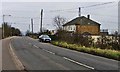
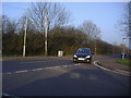
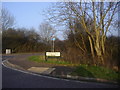
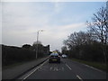
10 photos from this area
Area Information
Key information about the EN7 6WA including its size, population, and administrative classification.
- Area Type
- Postcode
- Area Size
- 1.3 hectares
- Population
- 1514
- Population Density
- 258 people/km²
House Prices in EN7 6WA
27
Properties
£390,991
Average Sold Price
£168,450
Lowest Price
£929,500
Highest Price
Showing 27 properties
| Address | Type | Beds | Baths | Last Sale Price | Last Sale Date | |
|---|---|---|---|---|---|---|
| 21 Shambrook Road, Cheshunt, EN7 6WA | Detached | 5 | 2 | £929,500 | Oct 2025 | |
| 39 Shambrook Road, Cheshunt, EN7 6WA | Retail | 3 | 2 | £565,000 | Sep 2022 | |
| 27 Shambrook Road, Cheshunt, EN7 6WA | Detached | 3 | 2 | £520,000 | Feb 2021 | |
| 53 Shambrook Road, Cheshunt, EN7 6WA | Detached | 4 | 2 | £530,000 | Aug 2020 | |
| 29 Shambrook Road, Cheshunt, EN7 6WA | Detached | 3 | 2 | £531,000 | Jul 2020 | |
| 19 Shambrook Road, Cheshunt, EN7 6WA | Detached | 4 | 2 | £555,000 | Jul 2020 | |
| 45 Shambrook Road, Cheshunt, EN7 6WA | Detached | 4 | 2 | £505,000 | Mar 2020 | |
| 7 Shambrook Road, Cheshunt, EN7 6WA | Detached | 4 | - | £710,000 | Sep 2016 | |
| 41 Shambrook Road, Cheshunt, EN7 6WA | house | - | - | £520,000 | Jul 2015 | |
| 11 Shambrook Road, Cheshunt, EN7 6WA | house | - | - | £557,500 | Sep 2014 |
Page 1 of 3
Energy Efficiency in EN7 6WA
Amenities
Schools
| Rank | School | Type | Entry gender | Ages |
|---|
Explore more schools in this area
Go to Schools tabDemographics
Household Size
Family (3-5 people)
most common
Accommodation Type
Houses
most common
Tenure
88
majority
Ethnic Group
White
most common
Religion
N/A
most common
Household Composition
N/A
most common
Age
47
median
Adults (30-64 years)
most common
Household Deprivation
N/A
with no deprivation
NS-SEC
37
in Lower managerial occupations
Explore more demographic insights in this area
Go to Demographics tabPlanning
Planning Constraints
- Flood RiskPremium
- Ramsar Wetland SitesPremium
- Area of Outstanding Natural BeautyPremium
- Protected Nature ReservePremium
- Protected WoodlandPremium