Area Overview for CO8 5JU
Photos of CO8 5JU
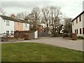
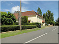
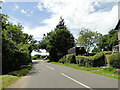
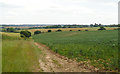
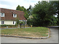
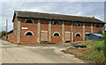
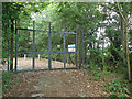
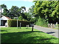
8 photos from this area
Area Information
Key information about the CO8 5JU including its size, population, and administrative classification.
- Area Type
- Postcode
- Area Size
- 38.2 hectares
- Population
- 1876
- Population Density
- 70 people/km²
House Prices in CO8 5JU
7
Properties
£309,310
Average Sold Price
£146,000
Lowest Price
£560,000
Highest Price
Showing 7 properties
| Address | Type | Beds | Baths | Last Sale Price | Last Sale Date | |
|---|---|---|---|---|---|---|
| Treetops, Bures Green, Bures St Mary, CO8 5JU | house | - | - | £560,000 | Jan 2022 | |
| April Corner, Bures Green, Bures St Mary, CO8 5JU | house | - | - | £205,000 | Sep 2019 | |
| Rose Cottage, Bures Green, Bures St Mary, CO8 5JU | Cottage | 3 | 1 | £425,552 | Feb 2016 | |
| Robin Cottage, 2 Bures Green, Bures St Mary, CO8 5JU | house | 2 | - | £146,000 | Jun 2010 | |
| Wild Orchard, Bures Green, Bures St Mary, CO8 5JU | Semi-detached | - | - | £210,000 | Aug 2001 | |
| Cow Parsley Cottage, Bures Green, Bures St Mary, CO8 5JU | Detached | 4 | 1 | - | - | |
| 3 Bures Green, Bures St Mary, CO8 5JU | house | - | - | - | - |
Energy Efficiency in CO8 5JU
Amenities
Schools
| Rank | School | Type | Entry gender | Ages |
|---|
Explore more schools in this area
Go to Schools tabDemographics
Household Size
Two person
most common
Accommodation Type
Houses
most common
Tenure
73
majority
Ethnic Group
White
most common
Religion
N/A
most common
Household Composition
N/A
most common
Age
47
median
Adults (30-64 years)
most common
Household Deprivation
N/A
with no deprivation
NS-SEC
39
in Lower managerial occupations
Explore more demographic insights in this area
Go to Demographics tabPlanning
Planning Constraints
- Flood RiskPremium
- Ramsar Wetland SitesPremium
- Area of Outstanding Natural BeautyPremium
- Protected Nature ReservePremium
- Protected WoodlandPremium