Area Overview for CO7 9LJ
Photos of CO7 9LJ
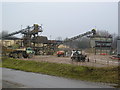
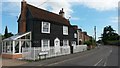
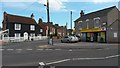
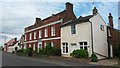
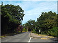
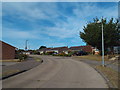
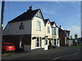
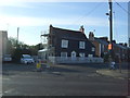
23 photos from this area
Area Information
Key information about the CO7 9LJ including its size, population, and administrative classification.
- Area Type
- Postcode
- Area Size
- 1.6 hectares
- Population
- 1527
- Population Density
- 1383 people/km²
House Prices in CO7 9LJ
29
Properties
£336,795
Average Sold Price
£136,500
Lowest Price
£570,000
Highest Price
Showing 29 properties
| Address | Type | Beds | Baths | Last Sale Price | Last Sale Date | |
|---|---|---|---|---|---|---|
| 112 Ernest Road, Wivenhoe, CO7 9LJ | Detached | 2 | 1 | £414,000 | Aug 2025 | |
| 109 Ernest Road, Wivenhoe, CO7 9LJ | Bungalow | 2 | 1 | £315,000 | Jan 2025 | |
| 87 Ernest Road, Wivenhoe, CO7 9LJ | Bungalow | 2 | 1 | £345,000 | Nov 2024 | |
| 99 Ernest Road, Wivenhoe, CO7 9LJ | Bungalow | 3 | 1 | £545,000 | Sep 2023 | |
| 103 Ernest Road, Wivenhoe, CO7 9LJ | Bungalow | 3 | 2 | £570,000 | Jun 2023 | |
| 101 Ernest Road, Wivenhoe, CO7 9LJ | Bungalow | 3 | 2 | £525,000 | May 2022 | |
| 113 Ernest Road, Wivenhoe, CO7 9LJ | Bungalow | 3 | 2 | £426,000 | Nov 2021 | |
| 114 Ernest Road, Wivenhoe, CO7 9LJ | Bungalow | - | - | £345,000 | Nov 2021 | |
| 83 Ernest Road, Wivenhoe, CO7 9LJ | Bungalow | 3 | - | £380,000 | Sep 2016 | |
| 90 Ernest Road, Wivenhoe, CO7 9LJ | Detached | 4 | 2 | £370,000 | Mar 2016 |
Page 1 of 3
Energy Efficiency in CO7 9LJ
Amenities
Schools
| Rank | School | Type | Entry gender | Ages |
|---|
Explore more schools in this area
Go to Schools tabDemographics
Household Size
Two person
most common
Accommodation Type
Houses
most common
Tenure
88
majority
Ethnic Group
White
most common
Religion
N/A
most common
Household Composition
N/A
most common
Age
47
median
Adults (30-64 years)
most common
Household Deprivation
N/A
with no deprivation
NS-SEC
48
in Lower managerial occupations
Explore more demographic insights in this area
Go to Demographics tabPlanning
Planning Constraints
- Flood RiskPremium
- Ramsar Wetland SitesPremium
- Area of Outstanding Natural BeautyPremium
- Protected Nature ReservePremium
- Protected WoodlandPremium