Area Overview for CO7 8DZ
Photos of CO7 8DZ
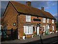
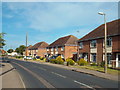
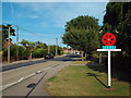
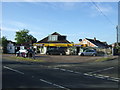

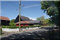
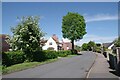
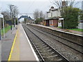
18 photos from this area
Area Information
Key information about the CO7 8DZ including its size, population, and administrative classification.
- Area Type
- Postcode
- Area Size
- 4429 m²
- Population
- 2464
- Population Density
- 363 people/km²
House Prices in CO7 8DZ
10
Properties
£216,588
Average Sold Price
£52,000
Lowest Price
£320,000
Highest Price
Showing 10 properties
| Address | Type | Beds | Baths | Last Sale Price | Last Sale Date | |
|---|---|---|---|---|---|---|
| 1 Oak Tree Road, Alresford, CO7 8DZ | Bungalow | 2 | 1 | £319,380 | Nov 2022 | |
| 4 Oak Tree Road, Alresford, CO7 8DZ | Retail | 3 | 1 | £285,000 | Jun 2022 | |
| 10 Oak Tree Road, Alresford, CO7 8DZ | Semi-detached | 4 | - | £320,000 | Nov 2021 | |
| 2 Oak Tree Road, Alresford, CO7 8DZ | Bungalow | 4 | 1 | £265,000 | Aug 2019 | |
| 8 Oak Tree Road, Alresford, CO7 8DZ | Chalet | 4 | - | £260,995 | Mar 2019 | |
| 5 Oak Tree Road, Alresford, CO7 8DZ | Semi-detached | 3 | - | £175,000 | Aug 2013 | |
| 9 Oak Tree Road, Alresford, CO7 8DZ | Bungalow | 2 | - | £142,000 | Aug 2011 | |
| 7 Oak Tree Road, Alresford, CO7 8DZ | Semi-detached | - | - | £184,000 | Apr 2008 | |
| 6 Oak Tree Road, Alresford, CO7 8DZ | Semi-detached | - | - | £162,500 | Oct 2003 | |
| 3 Oak Tree Road, Alresford, CO7 8DZ | Semi-detached | - | - | £52,000 | Jul 1995 |
Energy Efficiency in CO7 8DZ
Amenities
Schools
| Rank | School | Type | Entry gender | Ages |
|---|
Explore more schools in this area
Go to Schools tabDemographics
Household Size
Two person
most common
Accommodation Type
Houses
most common
Tenure
87
majority
Ethnic Group
White
most common
Religion
N/A
most common
Household Composition
N/A
most common
Age
47
median
Adults (30-64 years)
most common
Household Deprivation
N/A
with no deprivation
NS-SEC
32
in Lower managerial occupations
Explore more demographic insights in this area
Go to Demographics tabPlanning
Planning Constraints
- Flood RiskPremium
- Ramsar Wetland SitesPremium
- Area of Outstanding Natural BeautyPremium
- Protected Nature ReservePremium
- Protected WoodlandPremium